The phreatic eruption of Taal has me walking down the memory lane the past days. I remember my Volcanology training in June 2012 when my colleagues and I had the privilege to get mentored by former USGS Geologist and Volcanologist, Chris Newhall. This is going to be a short blog with the intention to share the photos of the workshop which I remember enjoying tremendously. I still have my notes from that workshop.
For the whole week of the workshop, Mayon Volcano showed her majestic self, the weather was good, and everything went on smoothly – from our flight going to Legaspi, Albay, to the fieldworks at the foot slopes of Mayon.For those who don’t know, Chris Newhall, is a volcanologist who worked alongside former PHIVOLCS Director Rey Punongbayan, in monitoring Mt. Pinatubo before, during, and after the eruption. He was the one who lent equipment to PHIVOLCS before the eruption.
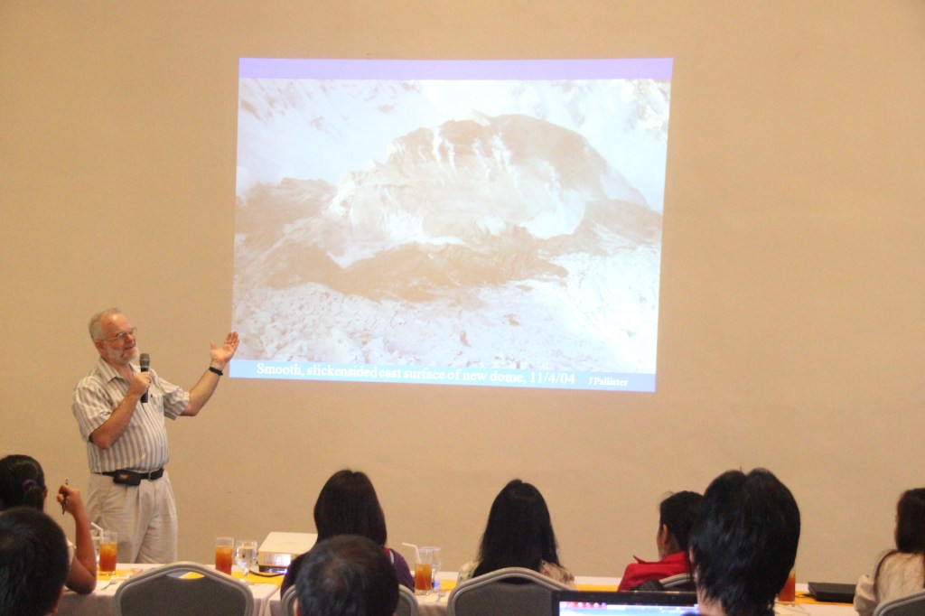
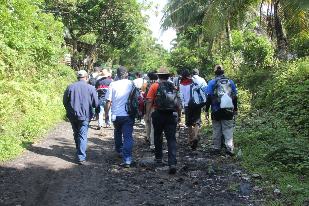
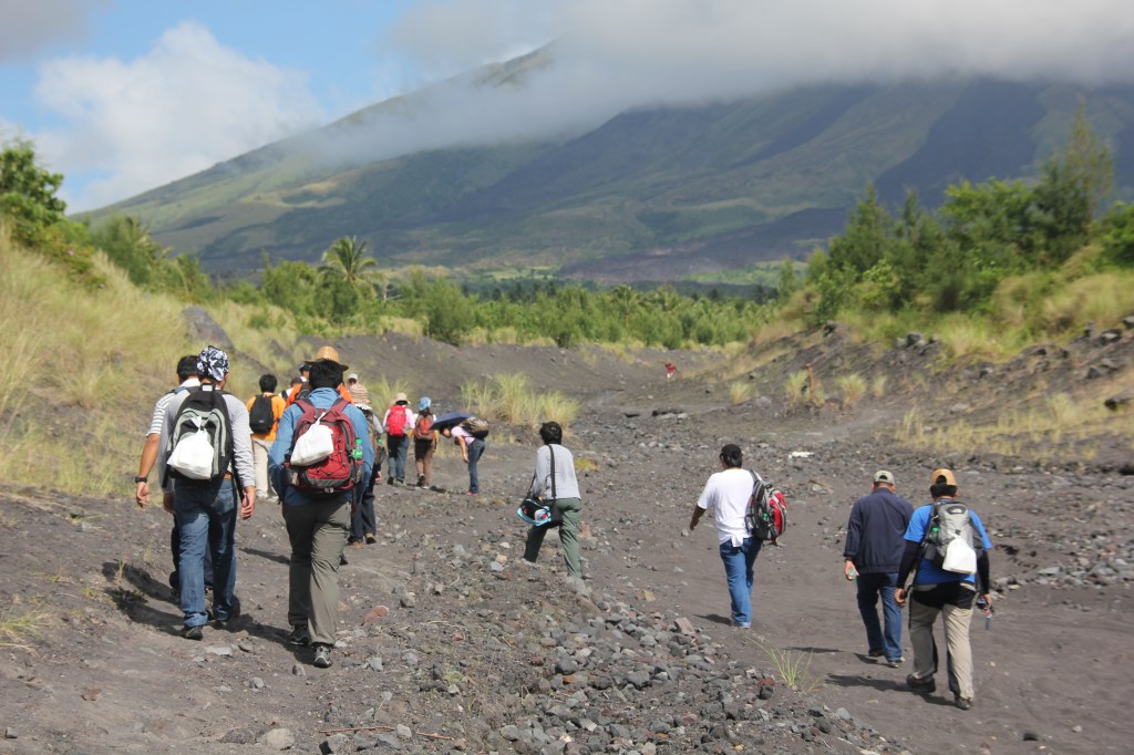
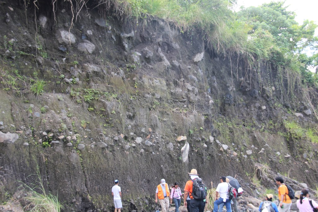
Chris Newhall, along side then director of PHIVOLCS, Rey Punongbayan, played a major role in monitoring the seismic activities and gas levels of Mt. Pinatubo before its eruption in 1991. He also devised the Volcanic Explosivity Index (VEI) which is a relative measures of explosivity of a volcanic eruption. During the workshop, Chris, taught me and my fellow geologists the different types of volcanoes; the rocks associated with different types of eruptions; the VEI; methods used for monitoring volcanic activities; and so much more. We also had a fieldwork at the foot slopes of Mayon where we walked for kilometers to map out and classify different types of volcanic rock deposits. The fieldwork ended at the foot of a well-preserved lava flow – a product of the volcano’s 2009 eruption. Below are the series of photos of our workshop:
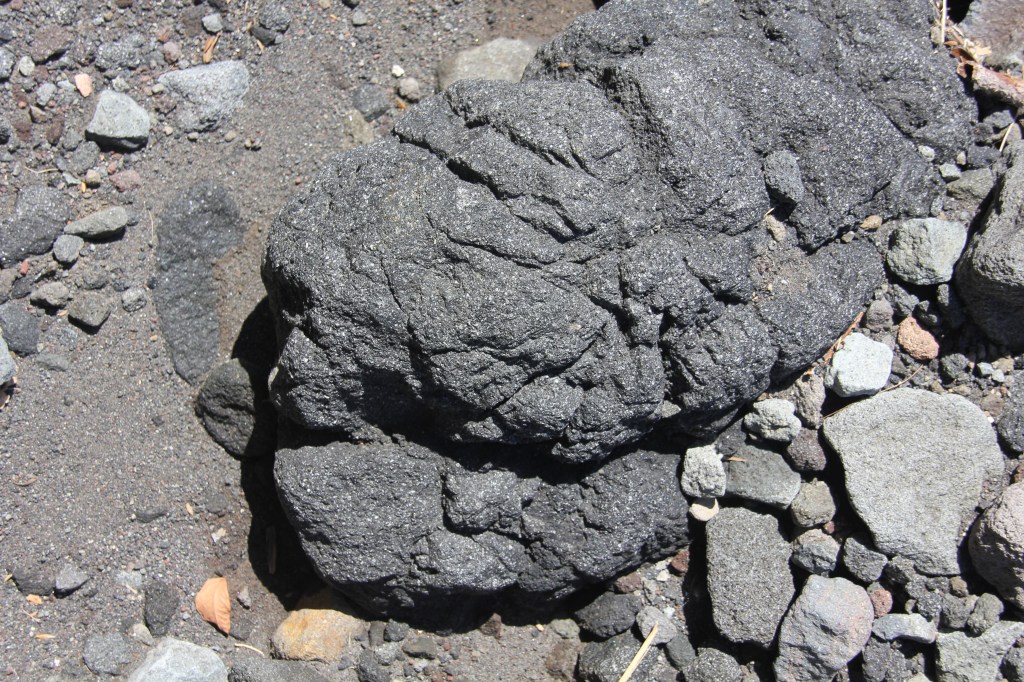
Chris Newhall explaining the explosivity index of Mt. St. Helens.Geologists, all geared up to walk for kilometers under the heat of the sun. 😉Do you see that black lava flow deposit of Mayon at the upper right side? That is the product of the volcano’s 2009 eruption. That’s where we’re going in this photo.Different layers of eruption materials such as tephra, ash, rock fragments, and volcanic glass. These layers are products of the eruption events of Mayon before 2009. Notice the big boulders of rocks at the layer before cogon grasses? That tells us that one of the eruptions before 2009 was so explosive, big chunks of rocks were thrown out this far. We call these boulders, volcanic blocks, which are usually rocks from the crater of a volcano. This is a volcanic bomb – a once partially molten volcanic material that got thrown out of the volcano during an eruption. Because it was partially molten, it got molded into bomb-like shape to oblate due to friction at the atmosphere then got fragmented (or broken up) once it hit the ground. The tiny fractures you see on this particular specimen was possibly due to steam + gas escaping from its molten core while it was solidifying.The whitish rock fragment in this volcanic bomb could be an old rock inside the volcano that got thrown out along with the bomb.
Sometimes the volcanic eruption can be so explosive, it breaks apart its crater rock and pieces get thrown out along with magma and steam. Imagine a coke bottle exploding and the dark cola liquid shoots up along with the shards of the glass bottle – eruptions can be like that. Exploded volcanic materials can also contain pieces of the rocks underneath the volcano. This is why clasts like in the photo above are also studied by Volcanologists in order to understand the type of rocks underneath the volcano which relates to the chemistry of the magma.
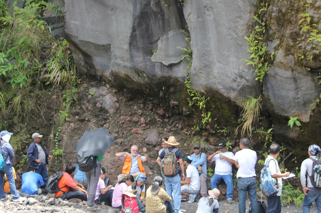
Do you see two layers or rocks here? One is brown (below) while the other is generally gray and looks like they’re composed of rounded cobbles or rocks (we call clasts) and fine fragments (we call groundmass).
Volcanologists also study the eruptive history of a volcano by characterizing the rocks surrounding it. Photo above shows brown fine-grained layer (bottom) which is possibly the old soil layer or the old ground. We usually call it “paleosol” or “fossil soil”. The grayish layer over this brown paleosol layer is a pyroclastic flow which formed when the eruptive column (or mushroom) of Mayon collapsed and flowed horizontally along its flanks covering the ground on its path. The reason why I took this photo was that this outcrop is a textbook example of pyroclastic materials getting deposited over the “old ground” level due to an eruption event. Volcanic eruptions play a significant role in changing the landscape. There won’t be islands on the Philippines were it not for volcanic eruptions millions of yeas ago – formed when layers of erupted volcanic materials got deposited on top of one another eventually becoming mountains and ridges, with valleys in between.
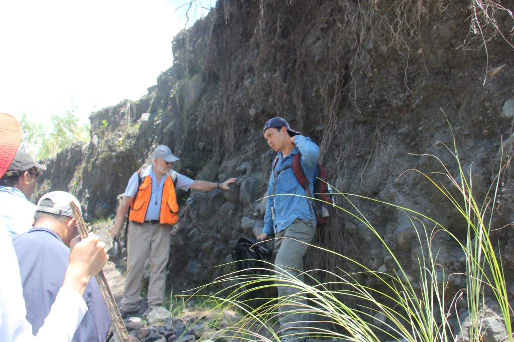
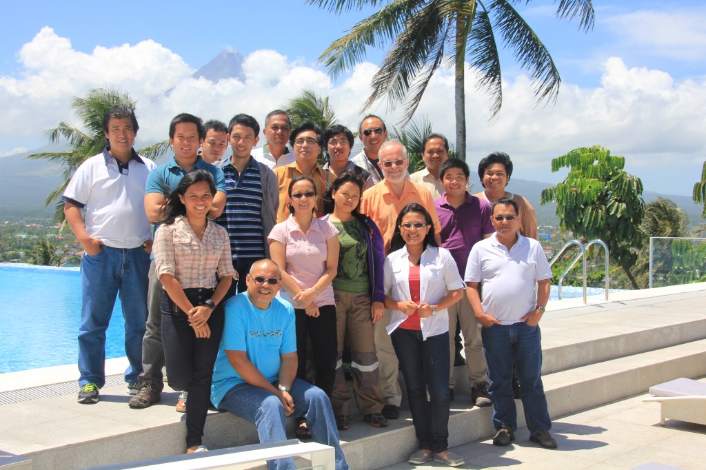
Cris Newhall teaching us how to characterize rocks layers around Mt. Mayon.In case you haven’t realized, the job of Geologists mean walking on foot, mapping rocks, and writing findings under the heat of the sun. It is hard work!Cris Newhall giving us lecture about this particular outcrop which shows two types of erupted flows from Mayon – pyroclastic (bottom layer) and lava flow (top layer). Lava flows are magma that spilled over the flanks of volcano – they usually harden into hard rocks like the one in this photo.We did rest a bit during the fieldwork. Haha!In this photo, we mapped out the general direction of the flow using the alignment of minerals particularly magnetites because these follow the direction of the magnetic north. Studying the direction of magnetites in different volcanic flows is why we know that throughout geologic history, the magnetic north and magnetic south has shifted a lot. What is now the magnetic north used to be the magnetic south and vice versa! That’s me in the center, beside Chris Newhall. 🙂 I loved working with these people! Behind us is Mayon. This shot was taken beside the pool of Oriental Hotel, Legaspi.
Discover more from The Fabulous Scientist
Subscribe to get the latest posts sent to your email.
Member, Philippine Guild of Watercolorists
Member, SEAPEX
Member, Geological Society of the Philippines
Data Science Enthusiast
Mom to Gugu and Chabibi
Pinay
View all posts by fabulousgrass


1 thought on “Volcanology 101 with Chris Newhall”