

This is an interactive, web-based GIS tool that allows you to see the danger zones in kilometer radius around the eruptive crater of Taal. It’s quite easy to follow, you and the kids will enjoy dong this together for sure! I’ve taken the following post from GeoRisk Philippines as also shared by PHIVOLCS on Facebook. Enjoy!
Visualizing Taal Volcano Danger Zones using HazardHunterPH
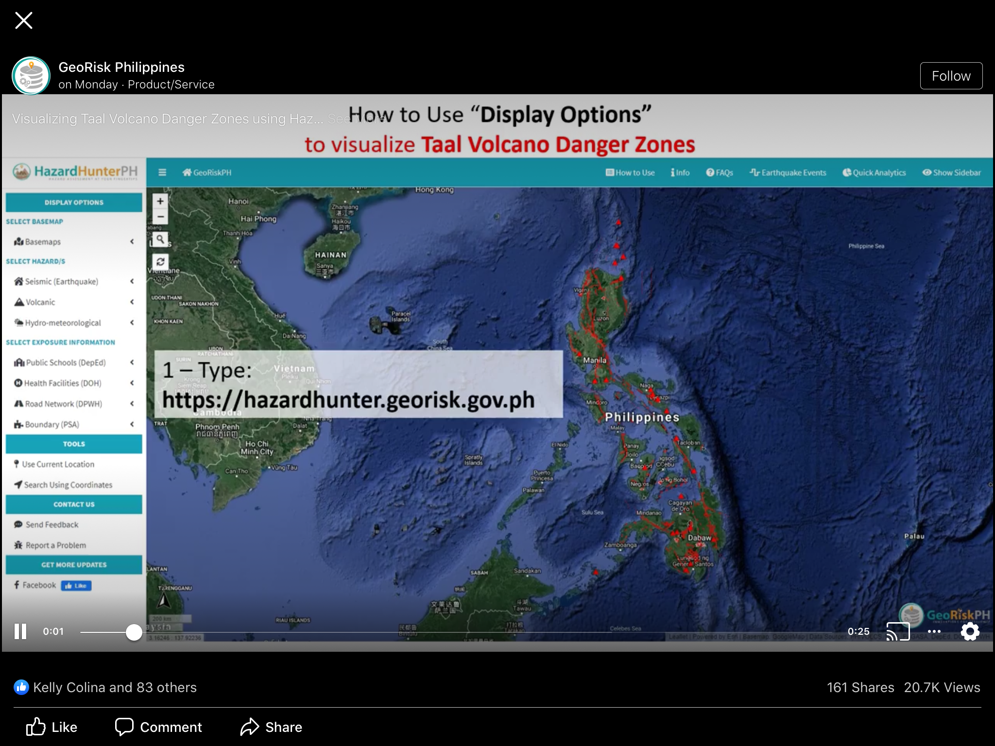
- Visit the HazardHunterPH web application: https://hazardhunter.georisk.gov.ph
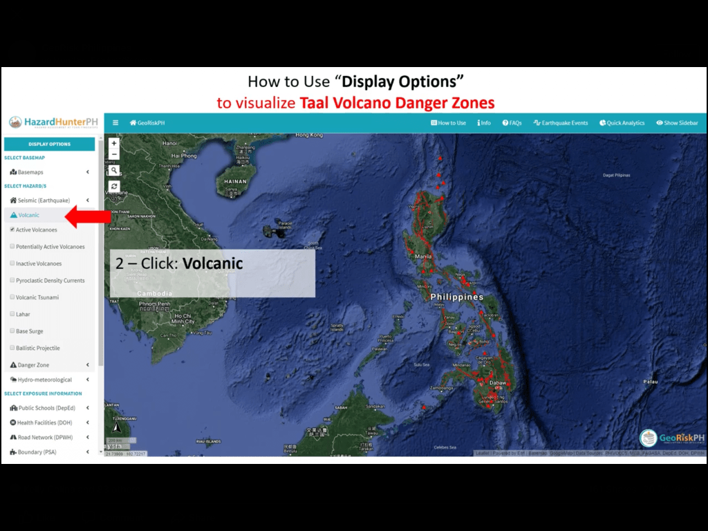
- On the left-side panel, click on the Volcanic Hazard under the Display Options section.
- A dropdown will appear displaying various layers that can be viewed on the map. Click on Danger Zone to see the list of Volcano Danger Zone layers.
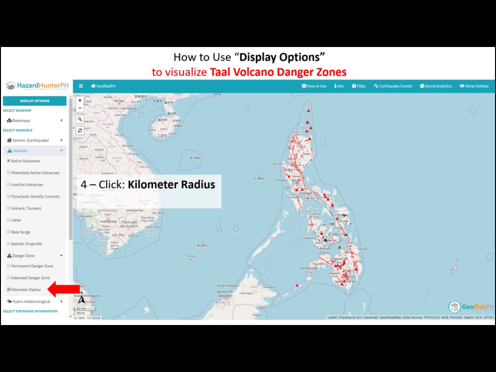
- Select the Kilometer Radius layer.
- Zoom in to Taal Volcano on the map to see the displayed radius layer measured from the volcano’s main crater.
View the demo video on YouTube: https://youtu.be/24ADcfTHWUw
Another option is to follow the video screenshots below for step-by-step use of HazardHunter:


Update: If you want to know the recent earthquakes in the country, click Earthquake Events at the top bar (screenshot below, encircled red) and it will show dots where the earthquakes were felt. A magnitude side bar showing depth and magnitude will up at the right side, which you can hide, anytime. Take note that your PC, tablet or phone, will blast a sound everytime a new earthquake happens.

The platform also has features where you can check for the nearest fault zones in your area, ranking in terms of landslide susceptibility and more! Feel free to message me here for questions.
TaalEruption2020 #TaalVolcano #GeoRiskPH #HazardHunterPH
Discover more from The Fabulous Scientist
Subscribe to get the latest posts sent to your email.

4 thoughts on “How to Check if Your Area is Within A Geological Hazard Danger Zone in Philippines”