

I’m so proud of the scientists and engineers of the Philippine Volcanology and Seismology (PHIVOLCS) for launching yet another app to help our countrymen get reliable information and updates about our active volcanoes in the country. The VolcanoPH app which was just launched today basically gives its users the latest bulletin and alerts about our active volcanoes. If you’re someone who lives near a volcano; a government official responsible for addressing emergency situations; a local government unit employee; a natural science student or simply someone who likes to keep track of our volcanoes (like me), this is an app for you.

I have already downloaded the app and will now give you a brief summary of its features and explain some of the terminologies in the app. Please do take note that I’m not a volcanologist – a kind of geologist specializing in volcanoes. I’m a geologist who specialized in petrology (rock and mineral identification) and geothermal geology. Geothermal geology is related to volcano since most of our geothermal energy source in the country are positioned underneath inactive or dead volcanoes. What I am an expert of is inactive volcanoes, and not the active ones. So the following explanations are based on my very basic knowledge of volcanology. But first, let me show you how VolcanoPH works through PHIVOLC’S instructional video below:
The App Details
Below are screenshots of the app’s first iteration. Take note that the app is currently available for download by Android phone users for now and the language is currently in Filipino. I asked PHIVOLCS during the webinar if the app will be available in other languages and they said that there will be an English version in the next iterations. For English speakers, that’s good news for you. 🙂
Once you open the app, the main dashboard will show you the pictures of active volcanoes in the country. You can click each photo to see list of monitoring updates about the volcano by PHIVOLCS.

If you click the upper left corner, a left sidebar will show up showing the list of volcano bulletins as well as settings for the app. You can choose to turn on the notification from the app by clicking “Maaring Baguhin”. Once turned on, you will receive a notification regarding app updates.

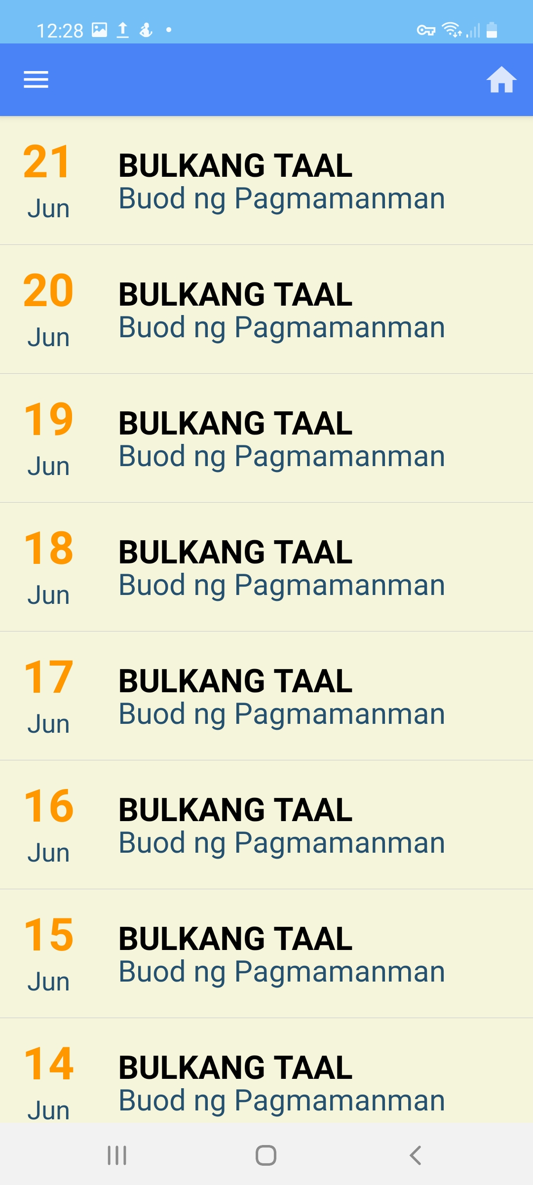
I clicked “Taal” from the left side bar and this brought me to the page that lists down all the bulletins about the volcano. I then clicked “21 Jun” to see the details.
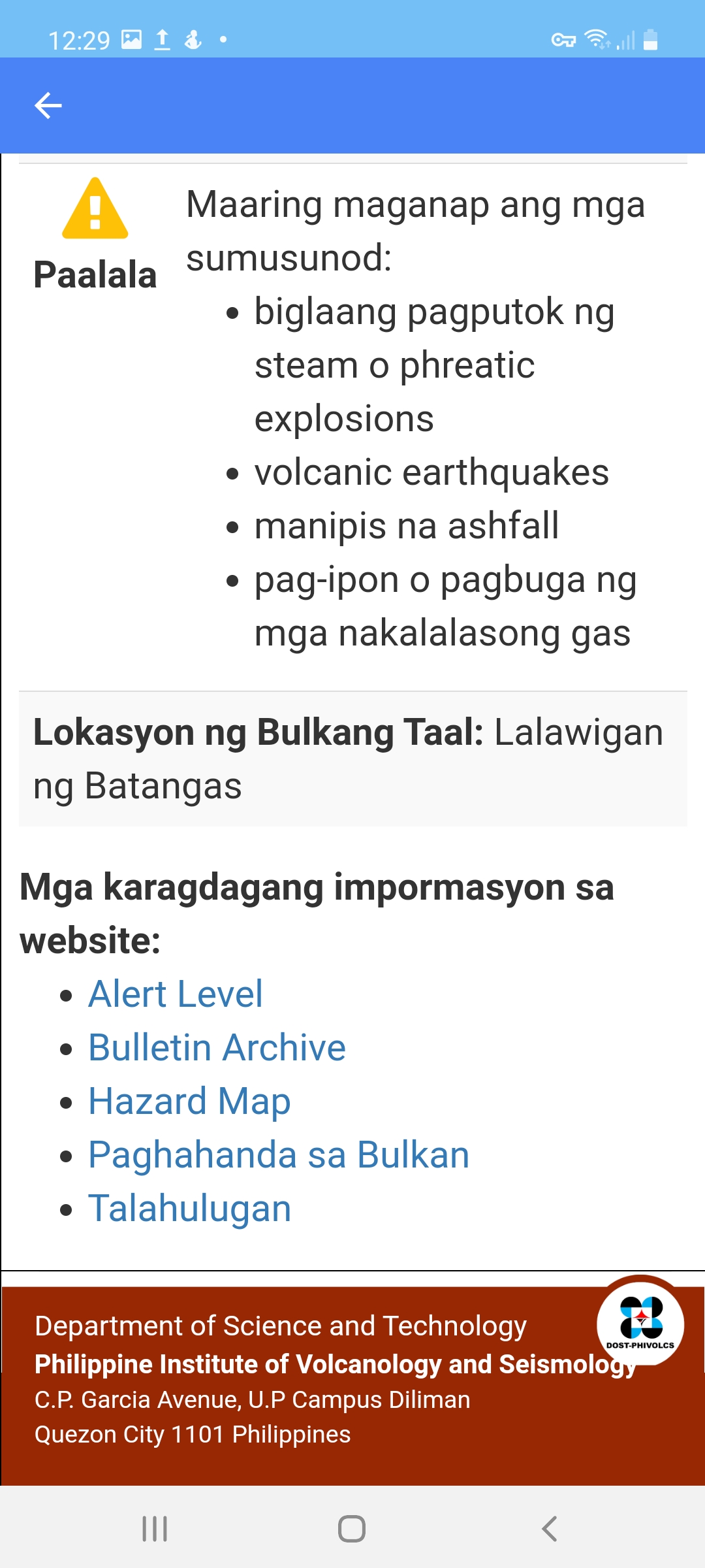
Below is the first page of the bulletin about Taal volcano which is currently at Alert Level 2. If you want to read about the different alert levels about volcanoes, I recommend that you visit the link about it in PHIVOLCS website. Each bulletin summarizes the results of the monitoring of the volcano for the last 24 hours. “Mga Parametro” is the list of parameters that volcanologists use to assess volcanic activities. Let us now dive right into each parameter.

Seismicity
Seismicity measures the number of earthquakes (frequency) in and around a volcano. Earthquakes can be a result of movement underneath a volcano – say for example magma pushing upwards and disturbing the rocks around it. In February 13, 2020, more than 2400 earthquakes were observed by PHIVOLC’s around Taal volcano, 176 of which were felt. This number of earthquakes occurred one month after the volcano erupted on January 12. Seismicity is a very important parameter that PHIVOLCS measure to help them assess if a volcano is about to blow up or not.
Acidity
Normal lakes typically is neutral, around pH 7, almost the same pH as that of your drinking water. Volcanic crater lakes particularly actives ones are typically acidic because these release gases into the atmosphere and the lake. Gases released by active volcanoes include carbon dioxide, sulfur dioxide, hydrogen sulfide, hydrogen chloride, and hydrogen fluoride. Mount Pinatubo’s crater lake had a pH of 1.9 (that’s acidic!) in 1992, 1 year after its eruption. As you can see in the picture above, Taal’s crater lake is even more acidic at pH level of 1.59.
Temperature
Temperature of crater lake is another parameter that our volcanologists monitor in the field. Without activity, crater lake’s temperature can just be around 30 degrees C. Currentl,y Taal’s main crater lake is hot at 71.8 degrees C and this could be due to water boiling activities (hydrothermal) happening underneath the lake. You can expect hydrothermal vents at any volcano and the way they affect the surface of the volcano such as decreasing lake water pH level as well as temperature are thus, important parameters that are closely monitored by our scientists.

Sulfur Dioxide Flux
Sulfur dioxide (SO2) levels of a volcano is also monitored because the amount of the gas released by active volcanoes can be correlated to the depth of the magma. Our scientists have equipment that measures this and complicated math that calculate the level of sulfur dioxide with respect to the possible depth of the magma. The shallower the magma body is, the more sulfur dioxide is observed. Last year during the week it erupted, Taal released more than 6000 tonnes of this gas per day.
Plume
Plume basically measures the height of the steam coming out of volcanoes. The higher the plume, the scarier it can be because that correlates to forceful degassing of a volcano which says about magmatic activity underneath.
Ground Deformation
When a molten magma body is forcing its way up a volcano’s vent, it’s disturbing the rocks around it and this can cause cracks to form around a volcano as well as grounds to subside or get elevated from its original position. Ground deformation was observed around Taal during its eruption last year. Our volcanologists at PHIVOLCS visit each site where ground deformation is observed to further verify if this is related to volcanic activities. Take note that ground deformation can be caused by other things as well such as earthquakes related to fault movement, landslides, or collapse of caves underneath (also known as sinkholes).
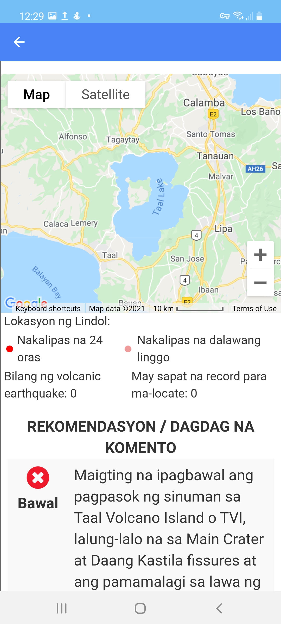
Near the bottom of the bulletin is a map that show the location of volcano. If you’re a map savvy, you can move the map around too. Also included in the bulletin are recommendations by PHIVOLCS for the locals living around or near the volcano. Recommendations by scientists are important for decision making by local government units as well as families that are within the danger zone. The beauty of this app is that it sends a text when alert level is at 2.
The app is so easy to use and navigate that even an non-techy person can use it. I think one of the good things of having an app like this is it allows you to see the bulletins straight from the experts. This means you don’t need to go searching for updates at social media or other news websites. It decreases the possibility of encountering fake news and misinformation which happened a lot last year at the height of Taal’s volcanic activity. Should you want to know more about our volcanoes, you can also click the links at the bottom of the bulletin. PHIVOLCS encourages the app users to also send their comments and suggestions for the improvement of the app.
Congratulations to PHIVOLCS team for coming with this app. By creating this app, our countrymen can now have access to information about our active volcanoes from the experts themselves. To our readerships, please follow PHIVOLCS for latest updates and don’t just believe any information you see on social media.
Kudos, PHIVOLCS!
In case you’re new here, I’ve also written about another hazard monitoring app, HazardHunterPH, which is an app that helps you identify if your location is prone to hazards such as flood, earthquake, volcanic-related risks, as well as landslides. HazardHunterPH app already combines data from the Mines and Geosciences Bureau, PAGASA, and PHIVOLCS.
Discover more from The Fabulous Scientist
Subscribe to get the latest posts sent to your email.

Hi nice readingg your post
LikeLike
Hello. Thanks! 🙂 I’m glad you like them.
LikeLike