
It’s been a while since I last wrote about Earth sciences, so I thought I’d kick things off with a blog post to teach your family about volcanoes. In this one, I’ll be sharing stories from my week-long fieldwork around Mayon Volcano and the Irosin Caldera. Now, you’ve probably heard of Mayon with its perfect cone, and maybe even Bulusan Volcano, which is still active today. But did you know that Bulusan actually sits inside a massive volcanic crater called the Irosin Caldera? It’s a mind-blowing fact that not everyone knows, but don’t worry—I’ll break it down in a simple way soon.
I’ve simplified a few things here to make it easy to understand, especially for younger readers. I didn’t include all of our photos because, well, we don’t want future volcanology students copying our work, do we? Plus, this article is more about sharing the fun experience rather than a deep dive into data. Speaking of fun, I also added some highlights from the trip, like the awesome food we enjoyed during our field mapping activity—because who doesn’t love food after a long day of hiking up a volcano?
If you enjoy this post, feel free to share it! It would be amazing to see more people appreciate the beauty and power of Mother Nature. And who knows? Maybe this will inspire some of you to think about becoming a scientist in the future. After all, science rocks! (Pun totally intended.)
Location 1: Mayon Volcano
Just like Mt. Fuji of Japan, Mayon volcano is a perfect cone-shaped active stratovolcano located in Albay, Bicol, a province in the southeastern part of Luzon island. From the city capital Manila, it’s only about 40-45-minutes plane ride or about 8-hours bus ride. Because our fieldwork to Mayon is part of our Volcanology class as graduate students, we took the school’s vehicle to get us there. The first stop after a long journey was to our accommodation in Sto. Domingo, Albay which is Mirisbiris Garden Resort. The resort is owned by a former US Geological Society scientist, Dr. Chris Newhall, who was my teacher in Volcanology in a one-week Volcanology 101 back in 2012 (blog post below). I will write about this resort in another post. If you like plants and the beach, this is one resort I’d recommend you stay in when you’re in Albay. More on Mirisbiris Nature Garden Resort in another post. 🙂
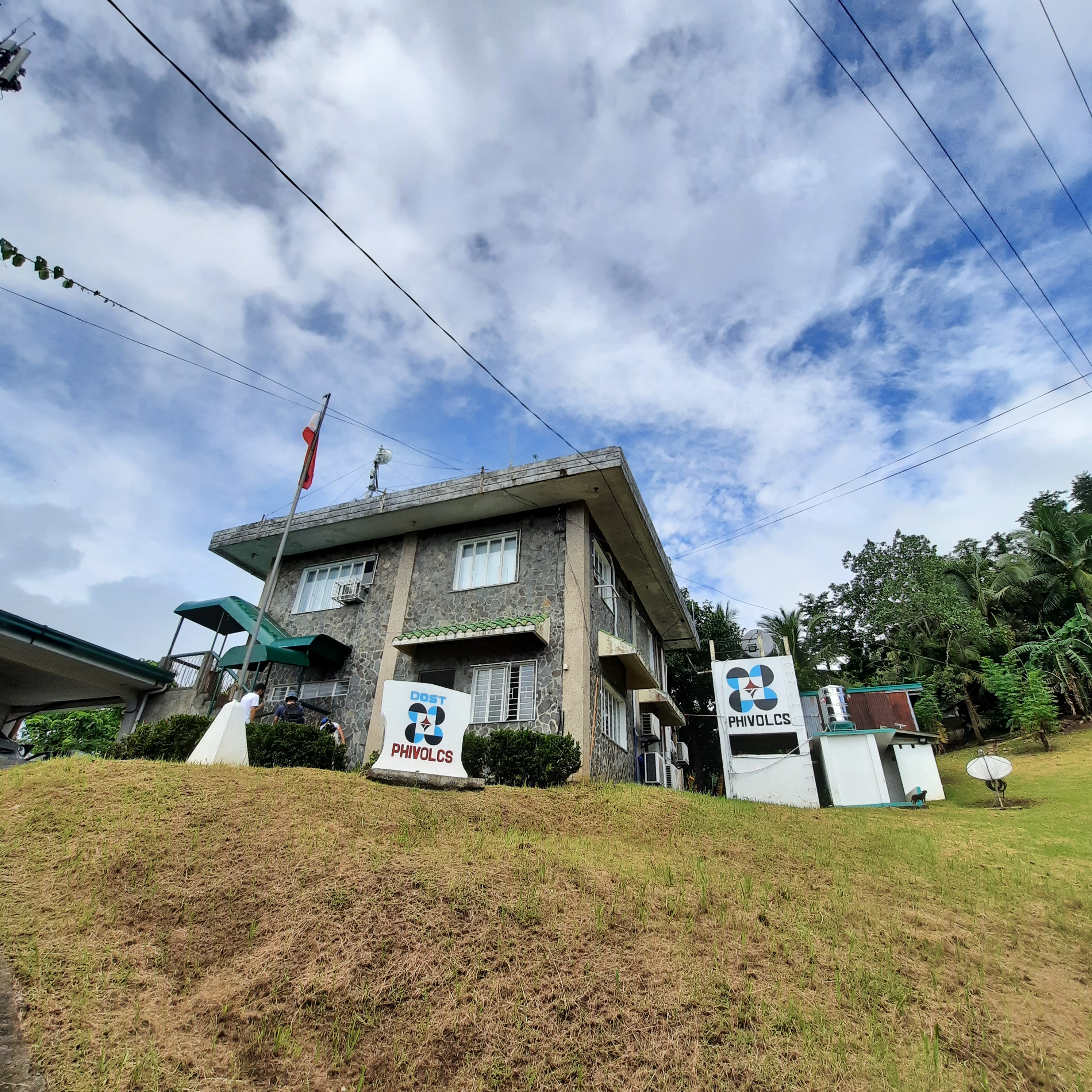
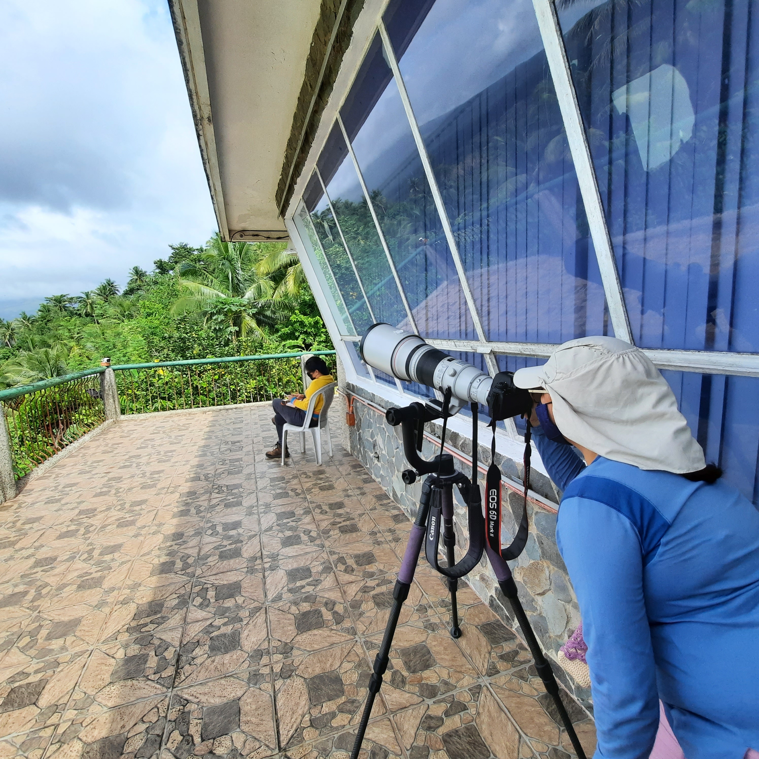
After nearly ten hours of travel, we arrived at the resort completely exhausted. I slept soundly that night, as if I hadn’t rested in days. The following morning, we prepared our gear for the first day of fieldwork. Our initial stop was the PHIVOLCS Observatory at Ligñon Hill, the main monitoring hub for Mayon Volcano. This center provides official scientific information about the volcano, perfect for educational purposes. The goal of our visit was to understand the equipment, methods, and data processing involved in monitoring volcanic and seismic activity around Mayon. The process is highly complex, and I won’t attempt to explain it all here, as I’m not an expert. If you’re curious to learn more, I highly recommend visiting the Observatory when you can. The scientists there are incredibly accommodating, though you’ll need to secure a permit from PHIVOLCS before your visit.
Mabinit Channel (Day 1)
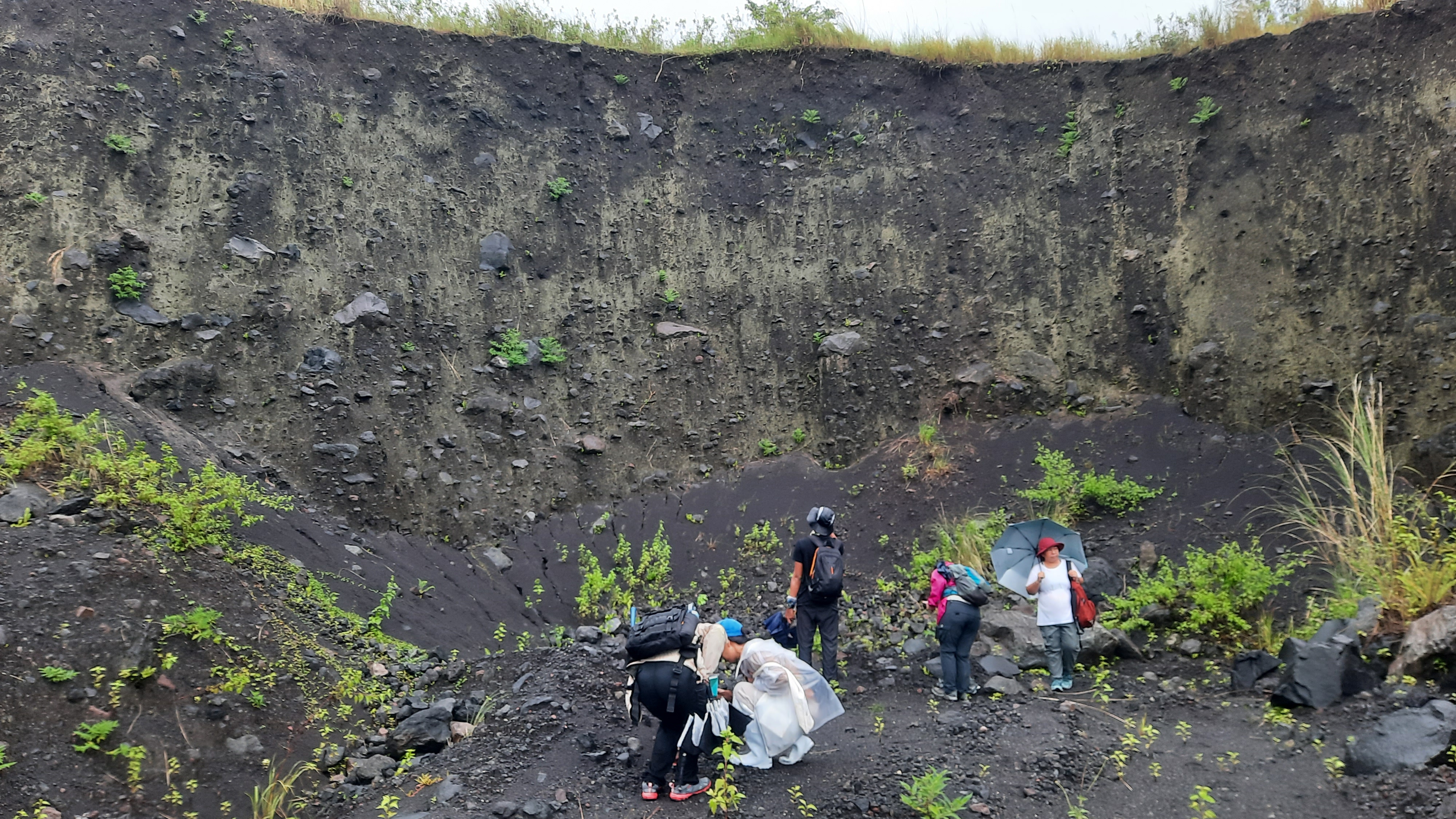
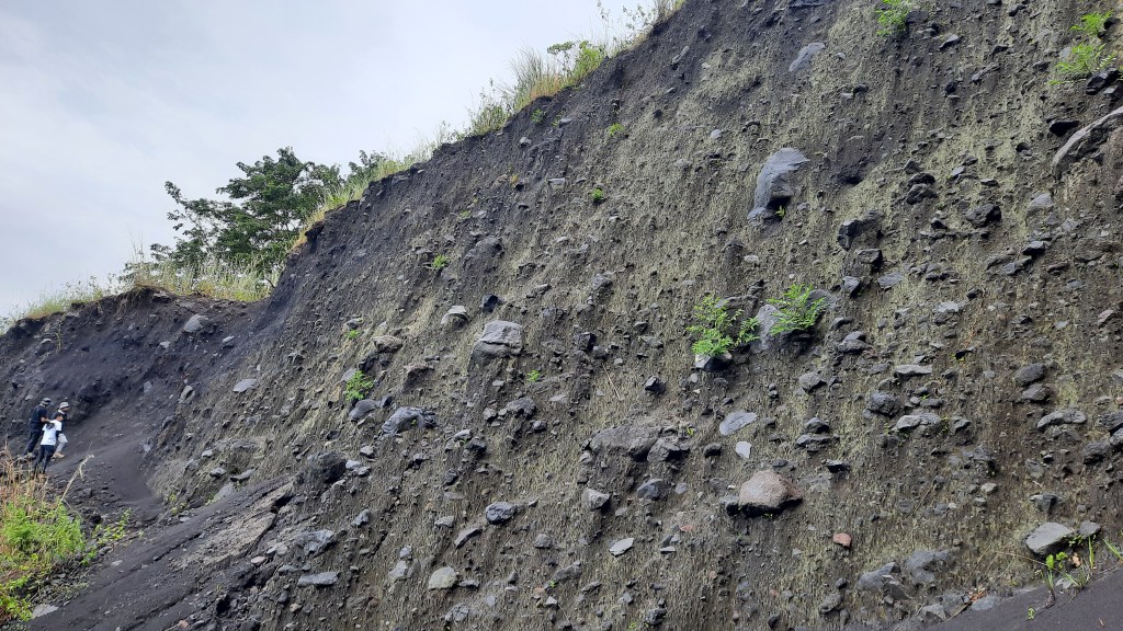
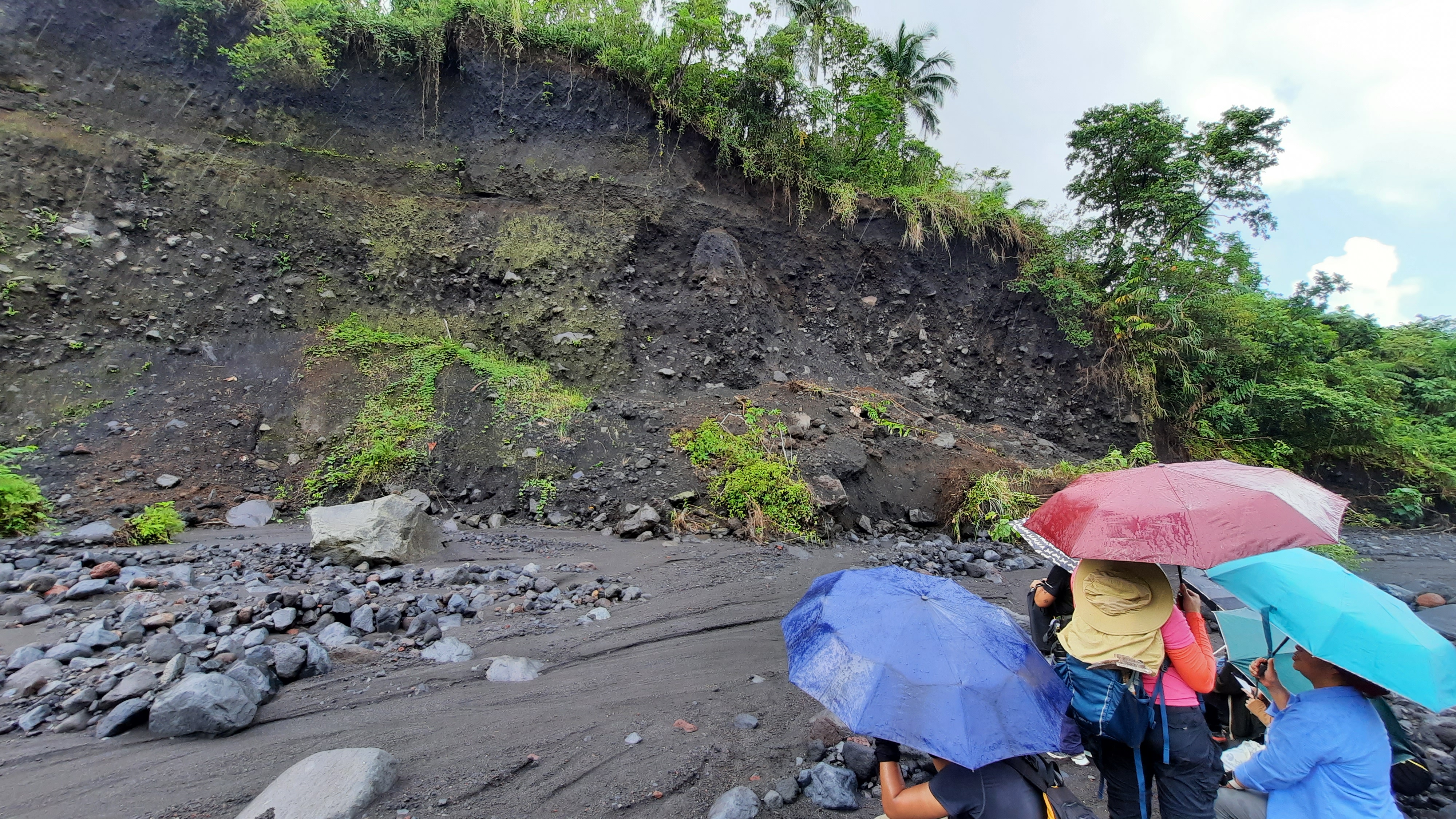
After our educational visit to the observatory, we headed back to our van, which would take us to Mabinit Channel—a site where erupted deposits from Mayon Volcano’s various eruptions are beautifully exposed. The drive from PHIVOLCS Observatory to the newly constructed bridge over the Mabinit Channel took about 30 minutes. From the bridge, we descended the concrete stairs of the retaining wall, or dike, built to protect the banks from erosion.
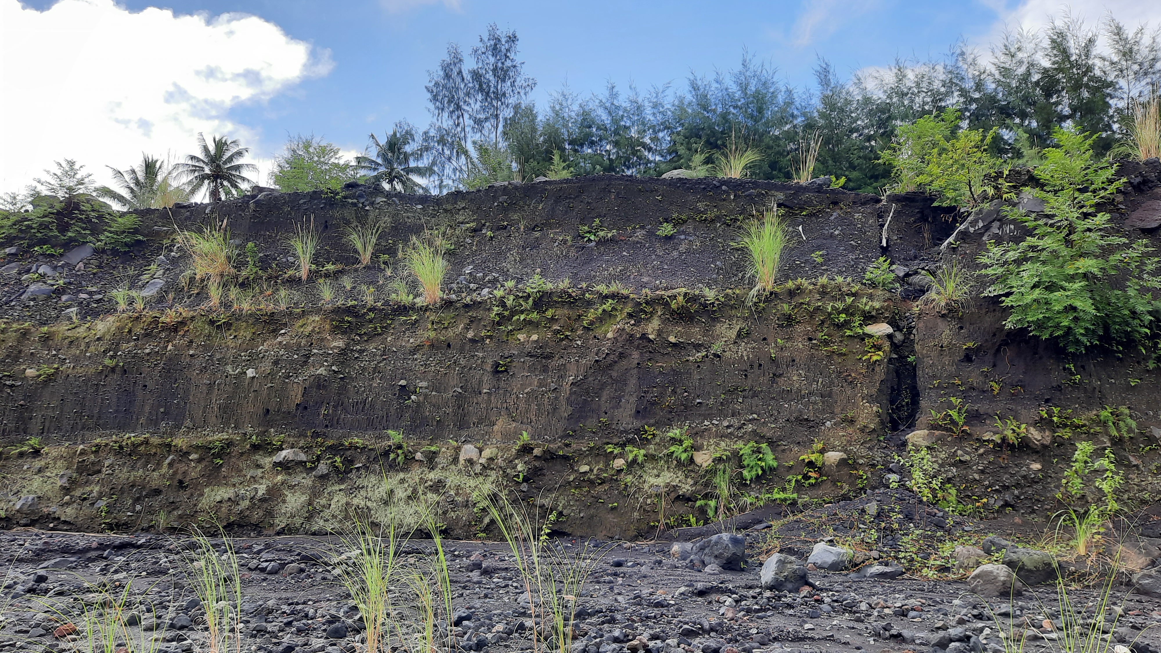
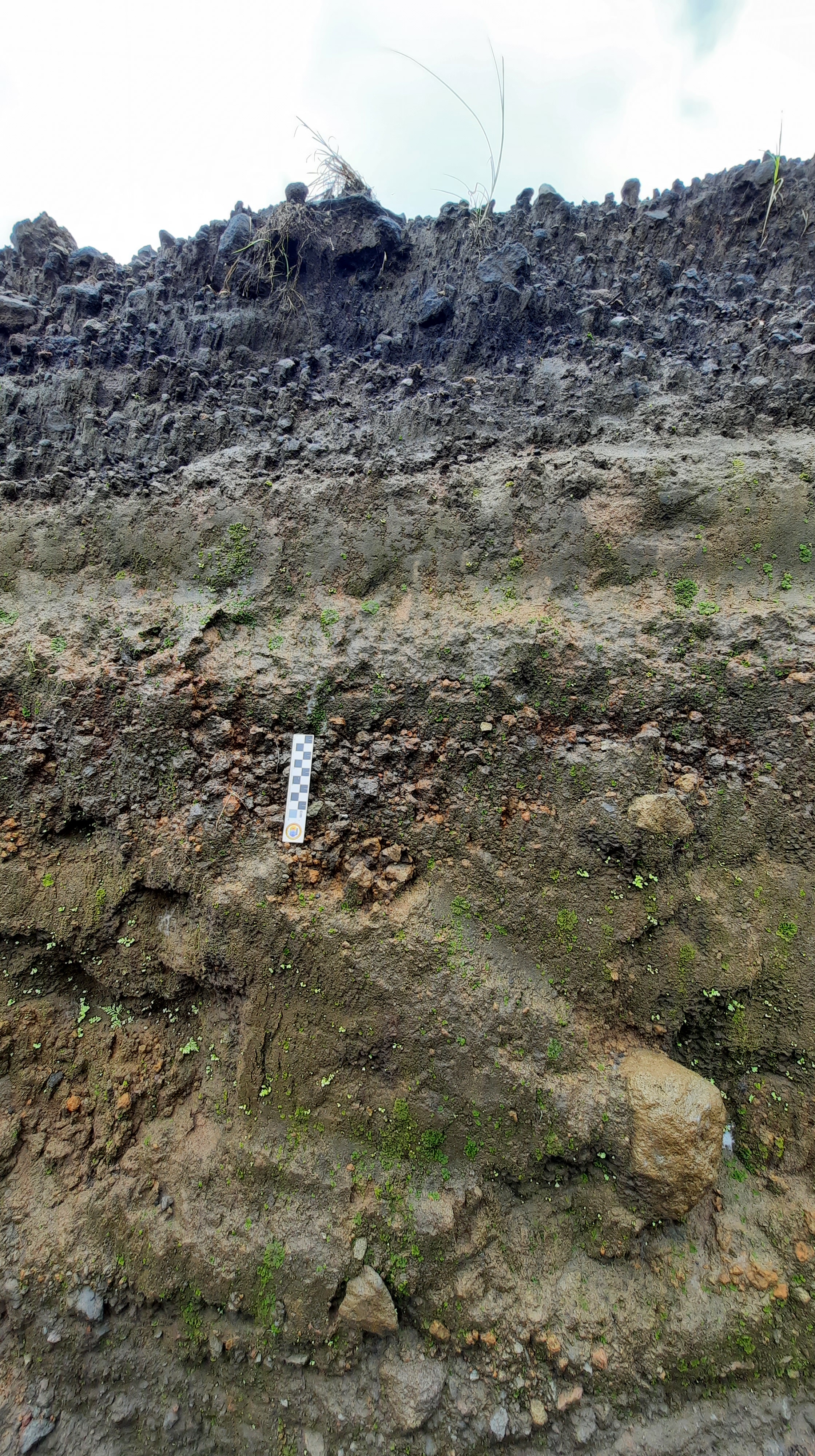
The banks of Mabinit Channel consist of multiple layers of lahar deposits. Each layer in the photo below likely represents a distinct lahar flow that passed through the channel over time. Lahar is a flow process where water, often from heavy rains, carries loose volcanic material down the slopes of the volcano. This sediment is deposited along the banks, and over time, it forms the stratified layers of deposits seen here. It’s important to note that lahar flows can occur not only during an active eruption but also years afterward. We’ve seen this happen with Mt. Pinatubo.
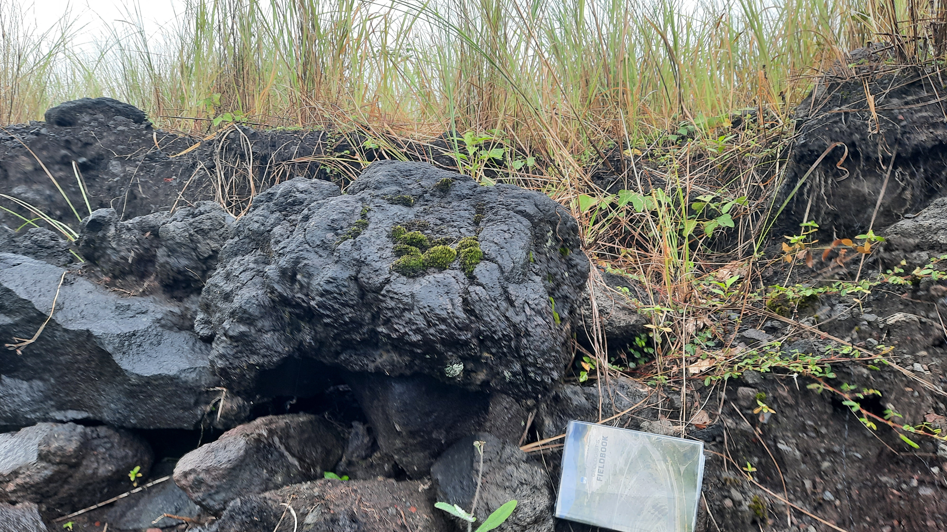
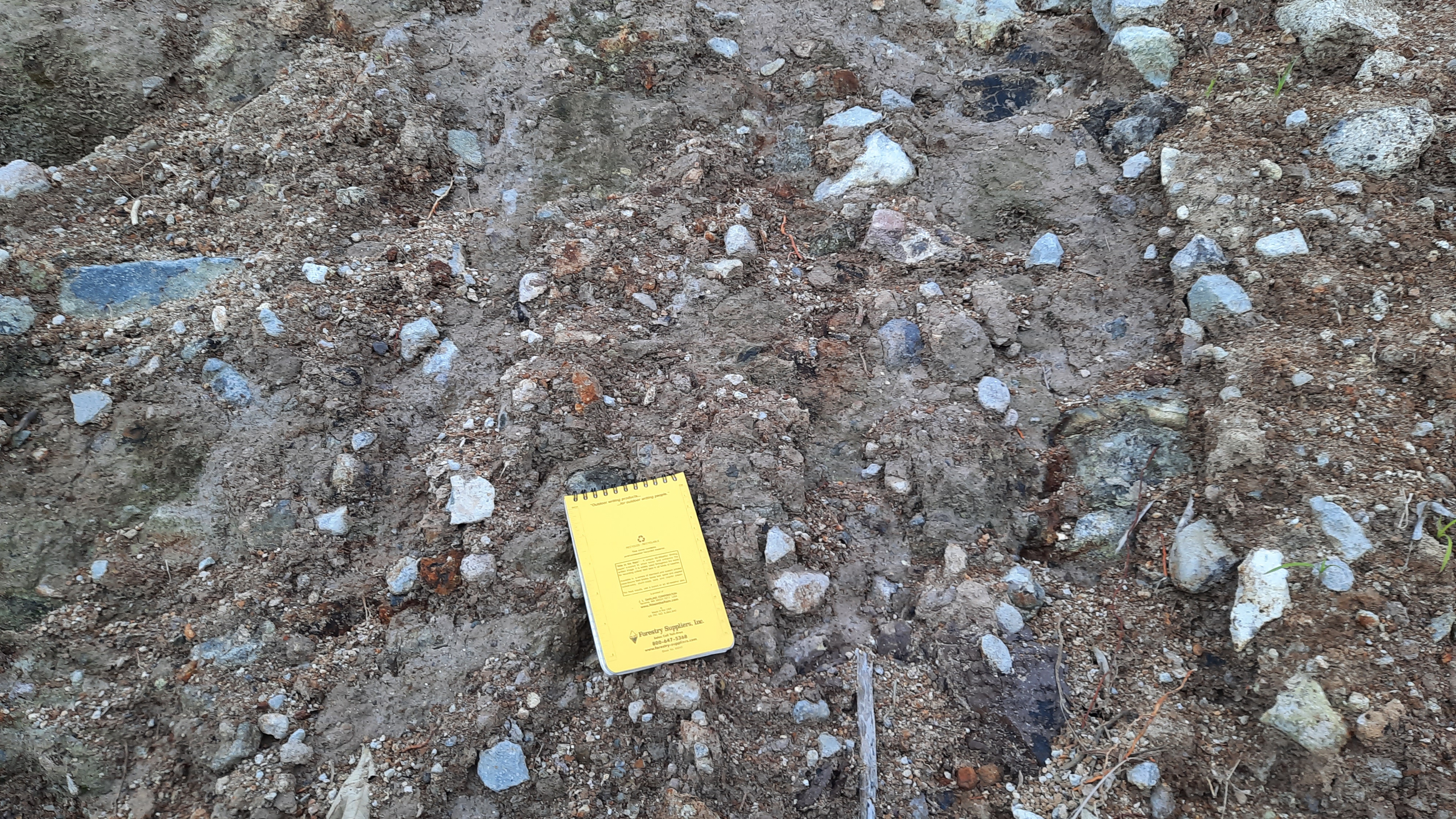
At our second stop along the channel, we came across a man-made ditch that revealed a layer of tephra fall deposits (see photo below). In geology, it’s essential to take photos of rocks or sediment layers, always with a scale ruler like the one shown. This serves two purposes: a) to clearly identify the layer or rock of interest and b) to provide a reference for grain size.
Sediment size is a critical detail in geological studies. In the photo, you can immediately observe that the tephra grains (the blocky, reddish-orange to brown particles) are, on average, larger than 1 cm. These grains were ejected from the volcano during a violent eruption, landing here as projectiles.
After documenting our observations of the tephra fall deposit, we continued trekking upstream along the channel. Our goal was to find and describe more volcanic deposits from Mayon, applying the theories we had learned in class. The weather that day was unpredictable, with intermittent rain followed by bursts of intense sunlight. The humidity was oppressive, and I regretted leaving my umbrella at the resort. All I had was a poncho, which helped during the rain, but became stifling when the sun came out again. Still, unpredictable weather is all part of the experience of being a geologist in the field. Sometimes, on days like this, I imagine myself as one of the hobbits on a journey to Mordor!
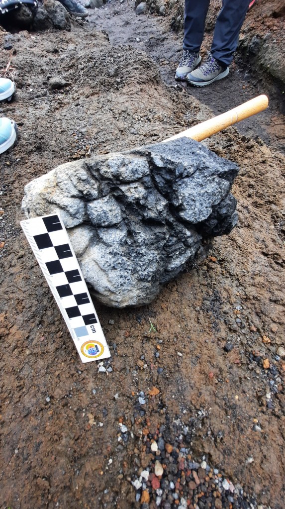
The photo on the left shows a volcanic bomb, one of the many projectiles from Mayon commonly found in the Mabinit Channel. The one we encountered here was relatively small compared to others, as we spotted bombs as large as one meter along the way.
After more than one hour of trekking, we finally saw the lava flow of Mayon from its eruption in 2006 (photo below). Notice how in just few years it’s already overgrown with vegetation. Soils that form over volcanic rocks are rich in nutrients such as magnesium, iron, calcium, and sodium. The sharp peaks you see in these lava flows are solid lava flow rocks – often the hardest part of the flow deposit.
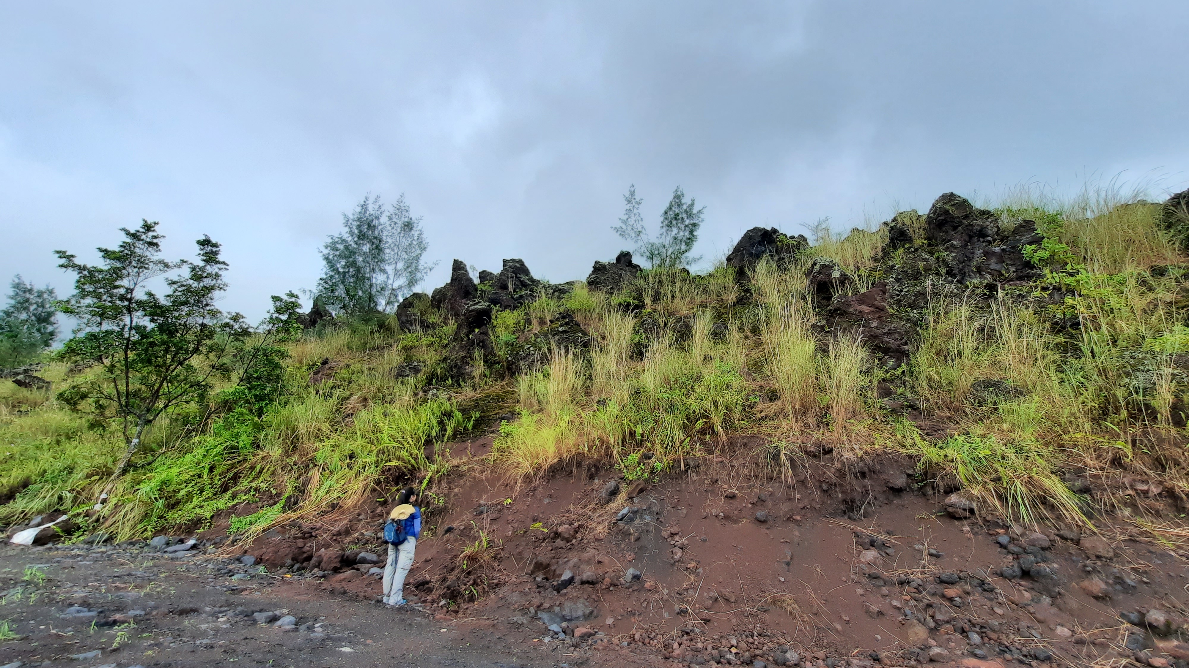
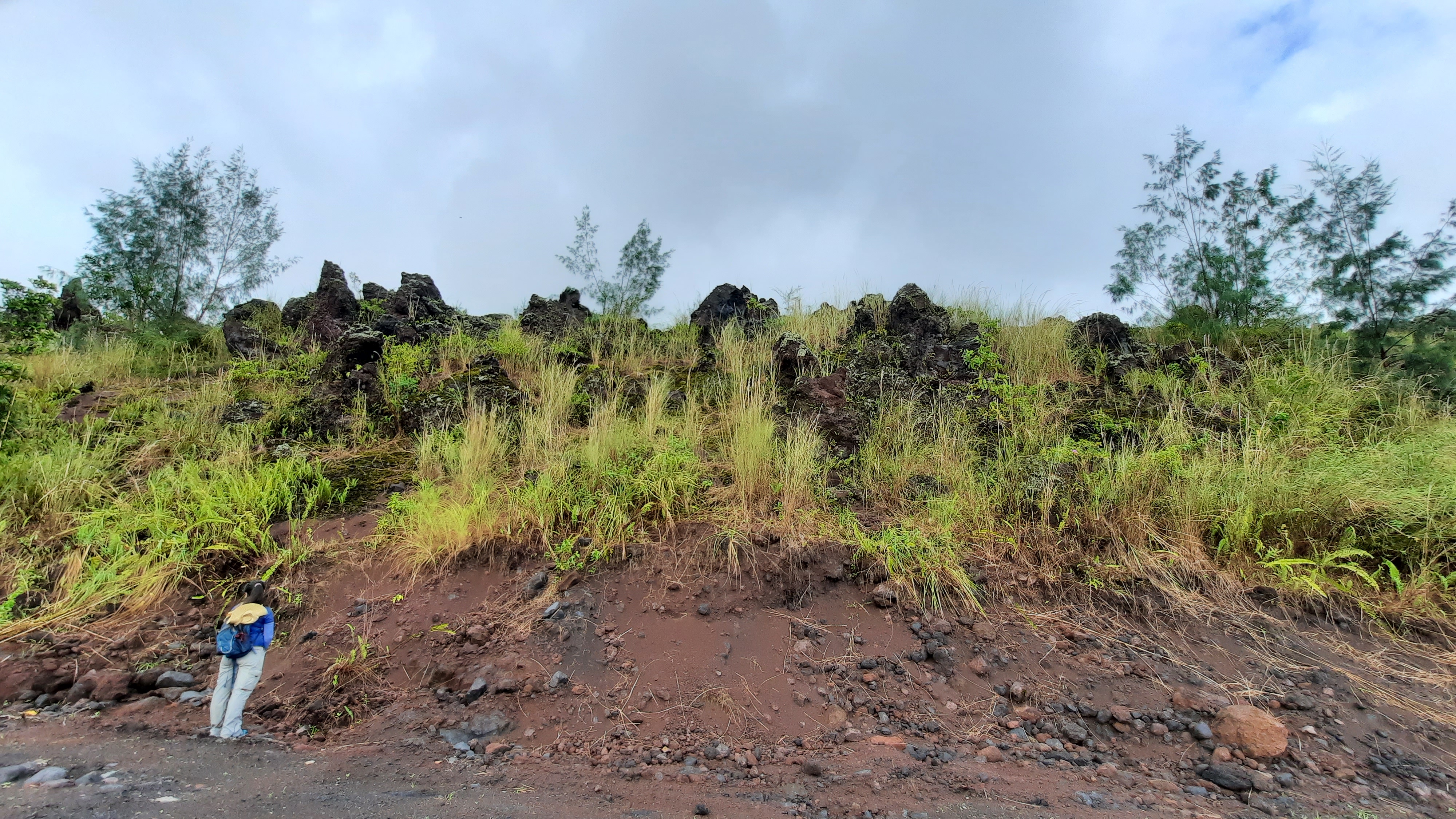
Mayon Volcano is classified as a stratovolcano because it alternates between producing lava flows and pyroclastic flows. The key difference between the two lies in their behavior. Lava flows, like the ones commonly seen in videos of Hawaiian volcanoes, involve hot molten rock cascading down the slopes of a volcano. These flows can vary in speed—some move slowly enough that people can outrun them to safety. However, this doesn’t mean it’s safe to approach! Lava flows are extremely dangerous, with temperatures reaching as high as 700 to 800 degrees Celsius (over 1200 degrees Fahrenheit). Approaching them is highly unsafe due to the intense heat.
A pyroclastic flow occurs during a particularly violent volcanic eruption, often when there is an excess of gas in the magma. During such an eruption, a towering eruption column is ejected from the volcano, containing volcanic bombs, tephra, molten rocks (magma), gas, and ash. Eventually, the column becomes too heavy to stay aloft and collapses, cascading down the slope as a pyroclastic flow, driven by gravity. These flows are incredibly fast and deadly.
Check out the video below, captured by a professional videographer, showing close-up footage of Mount Etna’s 2006 eruption. The photo on the left shows a pyroclastic flow deposit near the 2006 lava flow.
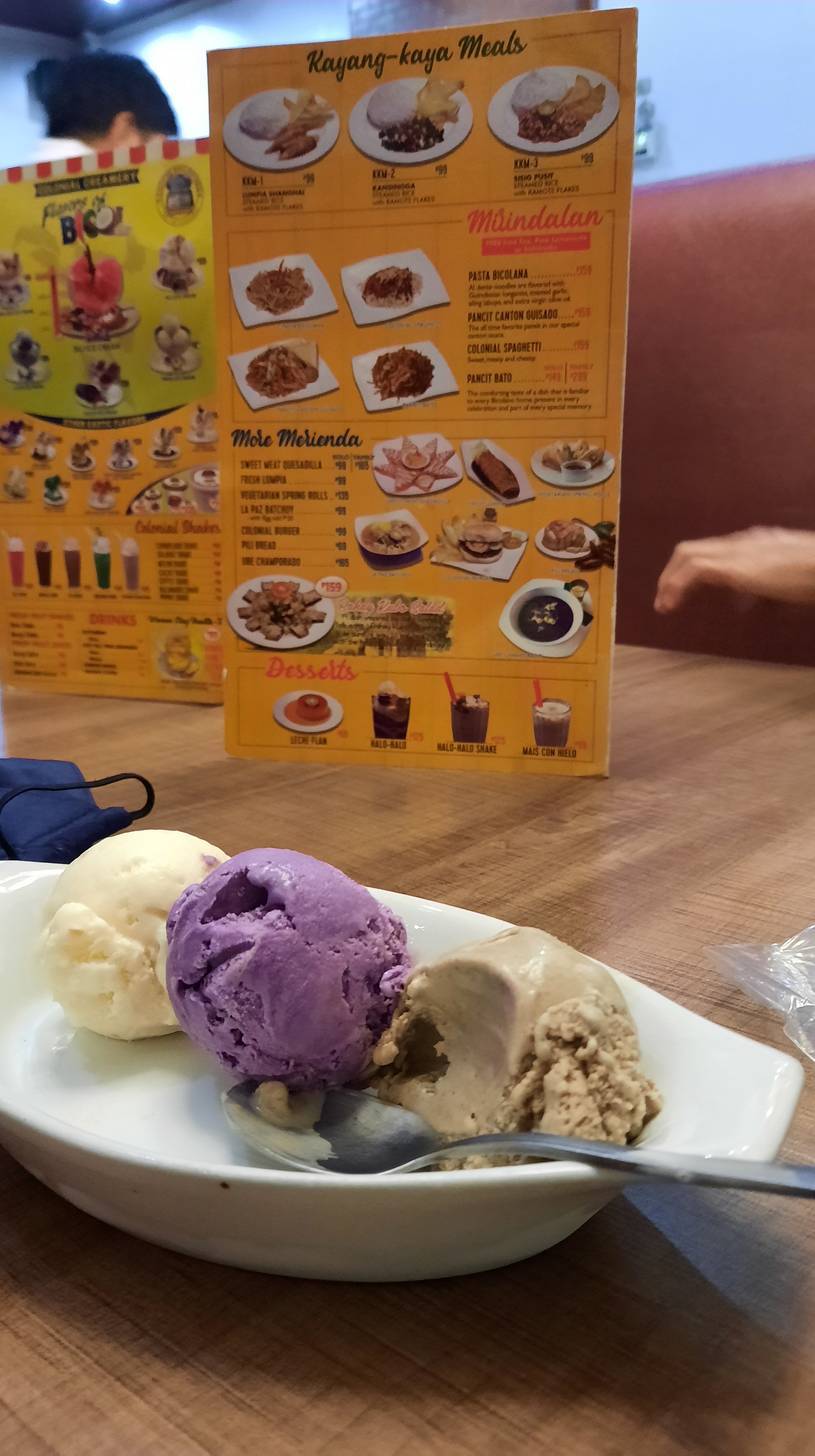
No trip to Bicol is complete without stopping by Colonial Grill for their famous ice cream. We navigated the busy streets of Legazpi just to get our hands on these frozen treats! Their signature flavor is “sili” ice cream—made with real chilies for the brave ones out there. While I’m not a fan of spicy ice cream, I have to give a big thumbs up to these three other flavors: tinotong na bigas (burnt rice), ube (purple yam), and gabi (taro). The best part? You can enjoy three scoops for just Php 99 (about 1.80 USD).
Basud Channel (Day 2)
Basud Channel lies northeast of Mabinit Channel. Just like Mabinit, we were able to observed pyroclastic flow deposits from different eruption periods of Mayon. Below are some of the photos with captions.
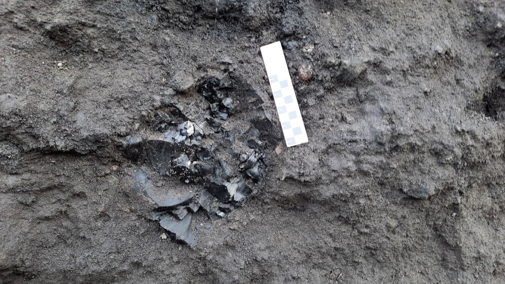
The pyroclastic flow deposits along Basud Channel are layered which indicate different violent eruptive events of Mayon volcano. The photo on the left shows charred wood – possibly a part of a tree that got hit by the hot pyroclastic flow during one eruption. Geologists often take samples of these for radiometric carbon dating.
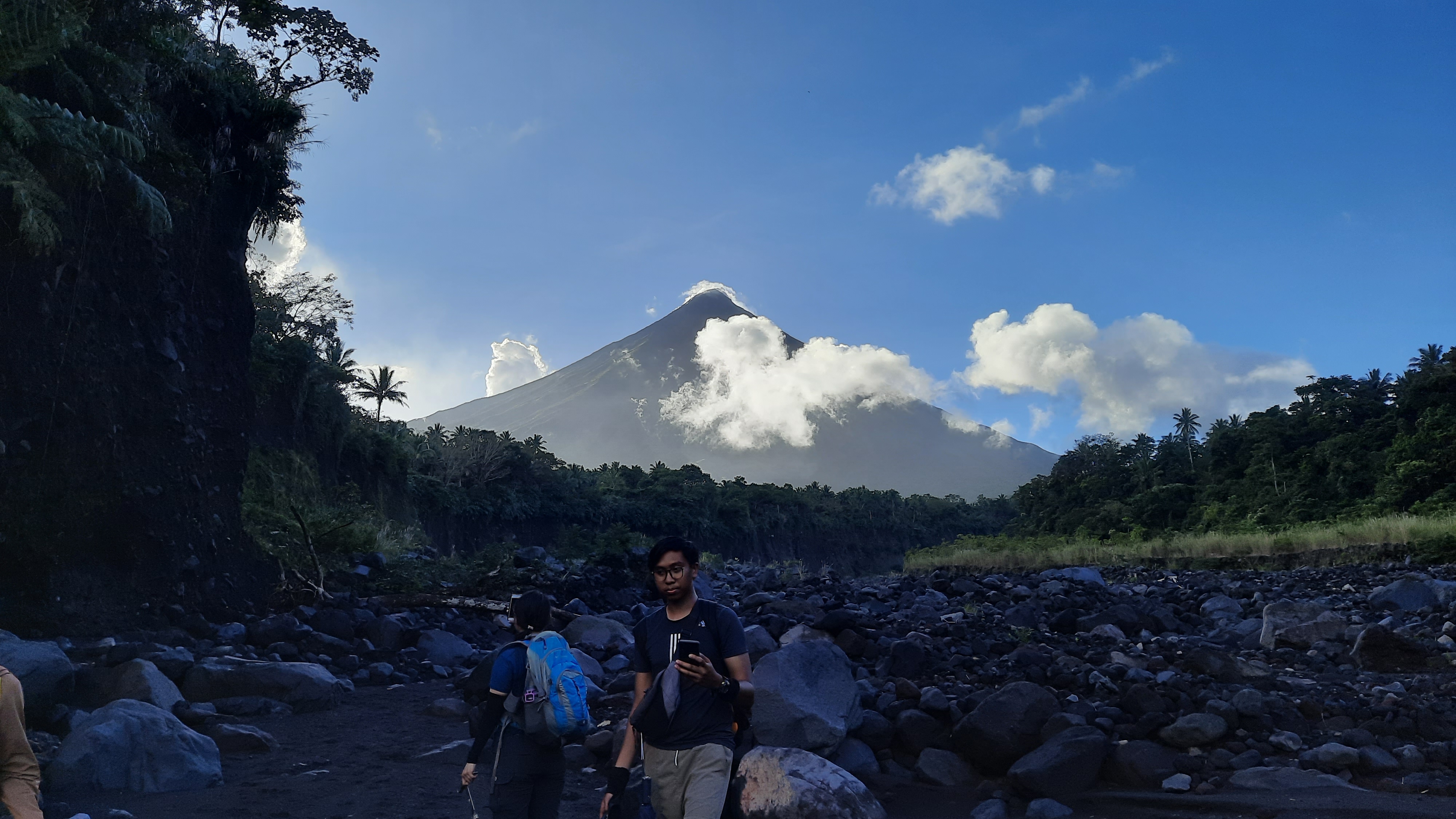
By the end of our trek, we realized we had unknowingly entered the 50-kilometer permanent danger zone of the volcano. Since it was already late in the afternoon, we decided to pause briefly and capture a photo of Mayon in all her majestic glory. After that, we quickly made our way back to the van, which took us to our base camp at Mirisbiris Resort.
Irosin Caldera, Sorsogon Province (Day 3-5)
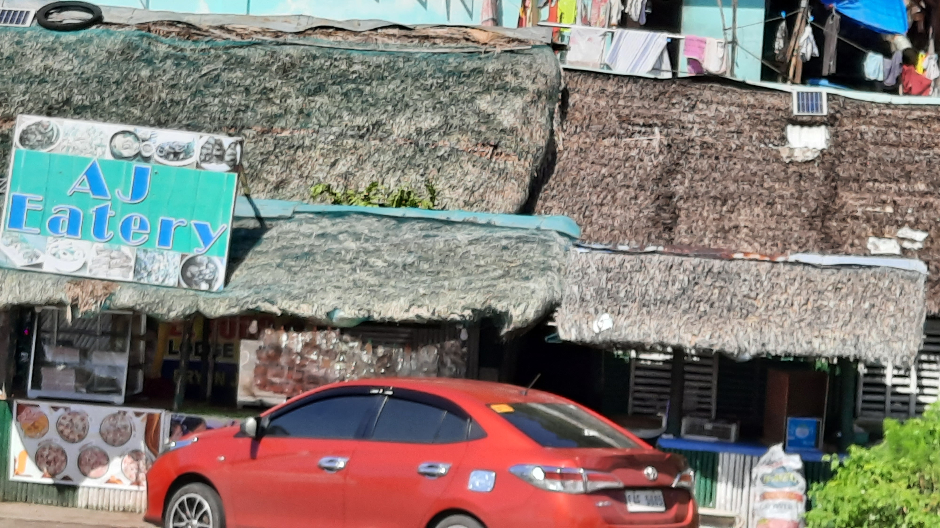
On the third day, we bid goodbye to Mayon and Mirisbiris Nature Garden Resort and went on our way towards Sorsogon to map out Irosin Caldera deposits. We had our first stop to have lunch at the famous eatery in Sorsogon, AJ Eatery.
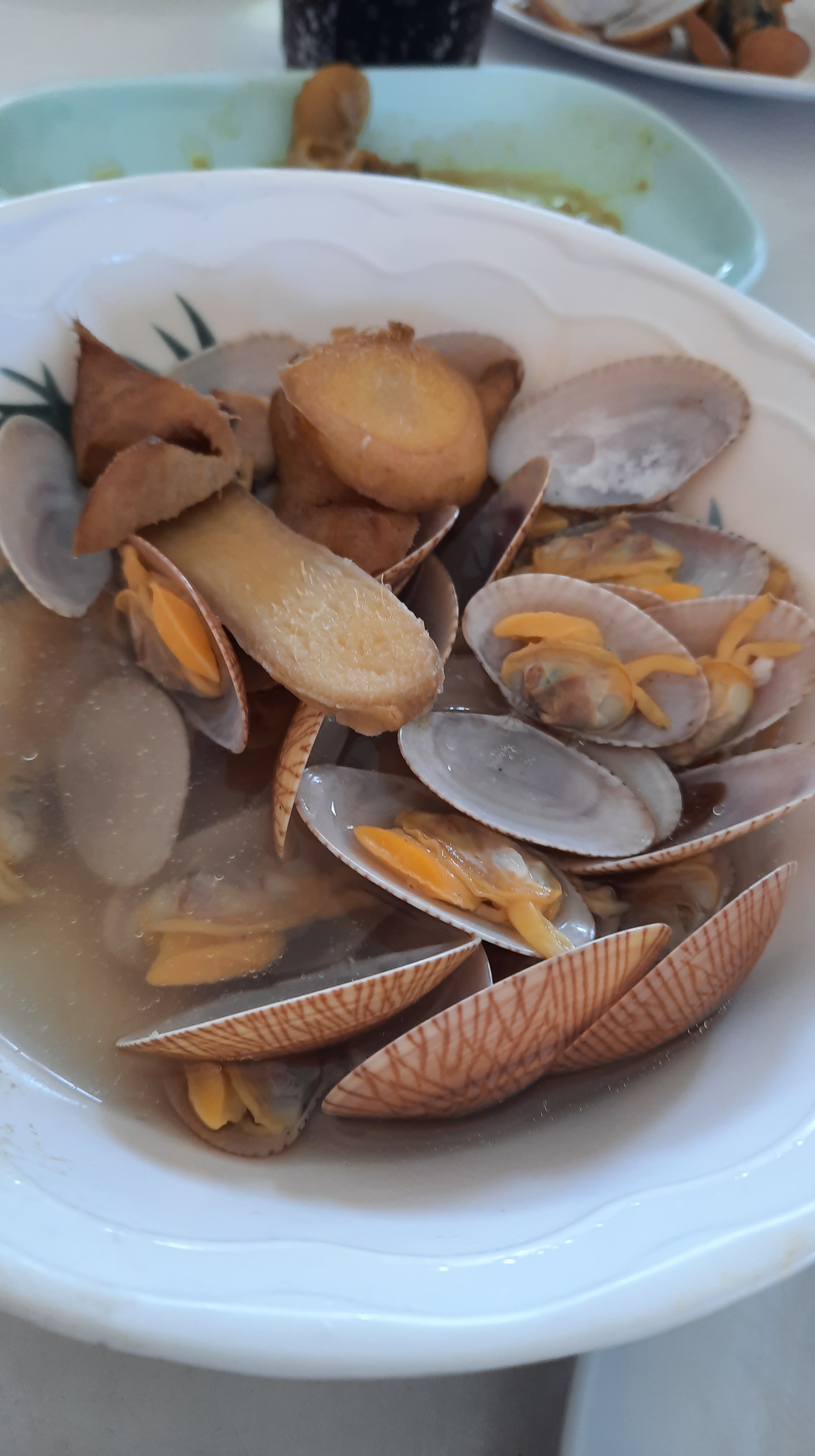
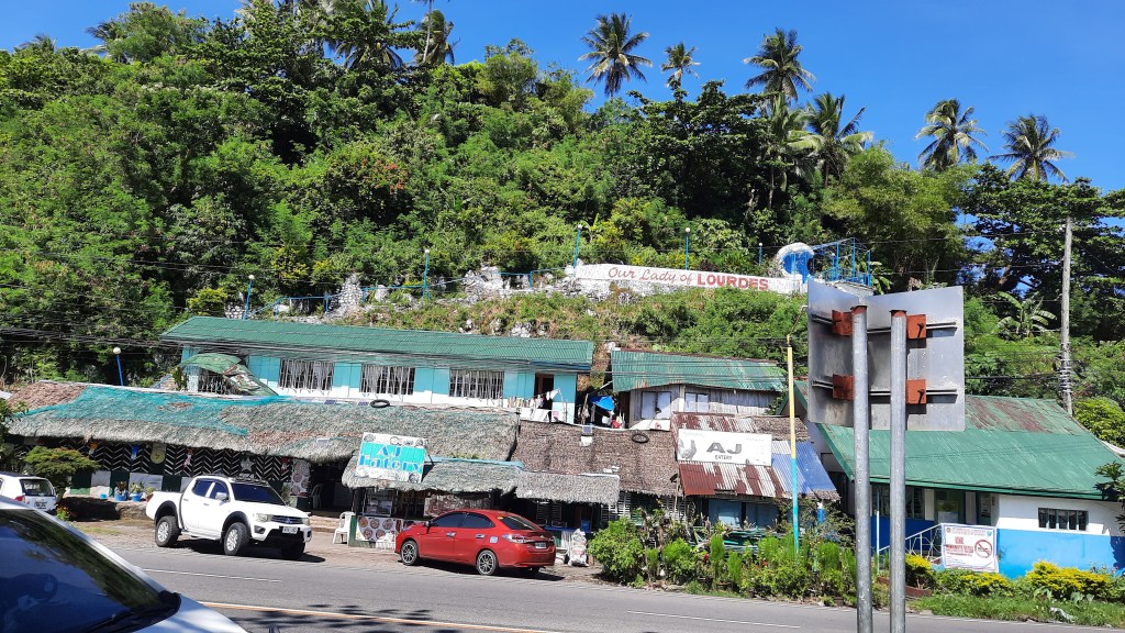
AJ Eatery, positioned along the highway with a good view of Sorsogon Bay, is famous for their affordable but yummy Bicol dishes. I have dined here several times before along with colleagues at the previous company I worked in. The photo on the left is my favorite dish from this eatery, locally called badoy. It’s a type of soup made of bivalve shellfish that are sautéed with onion, garlic, and ginger, then added with water. The ginger and onion flavors plus the natural flavor of the shellfish always get a thumbs up from me! Try this when you’re in Bicol.
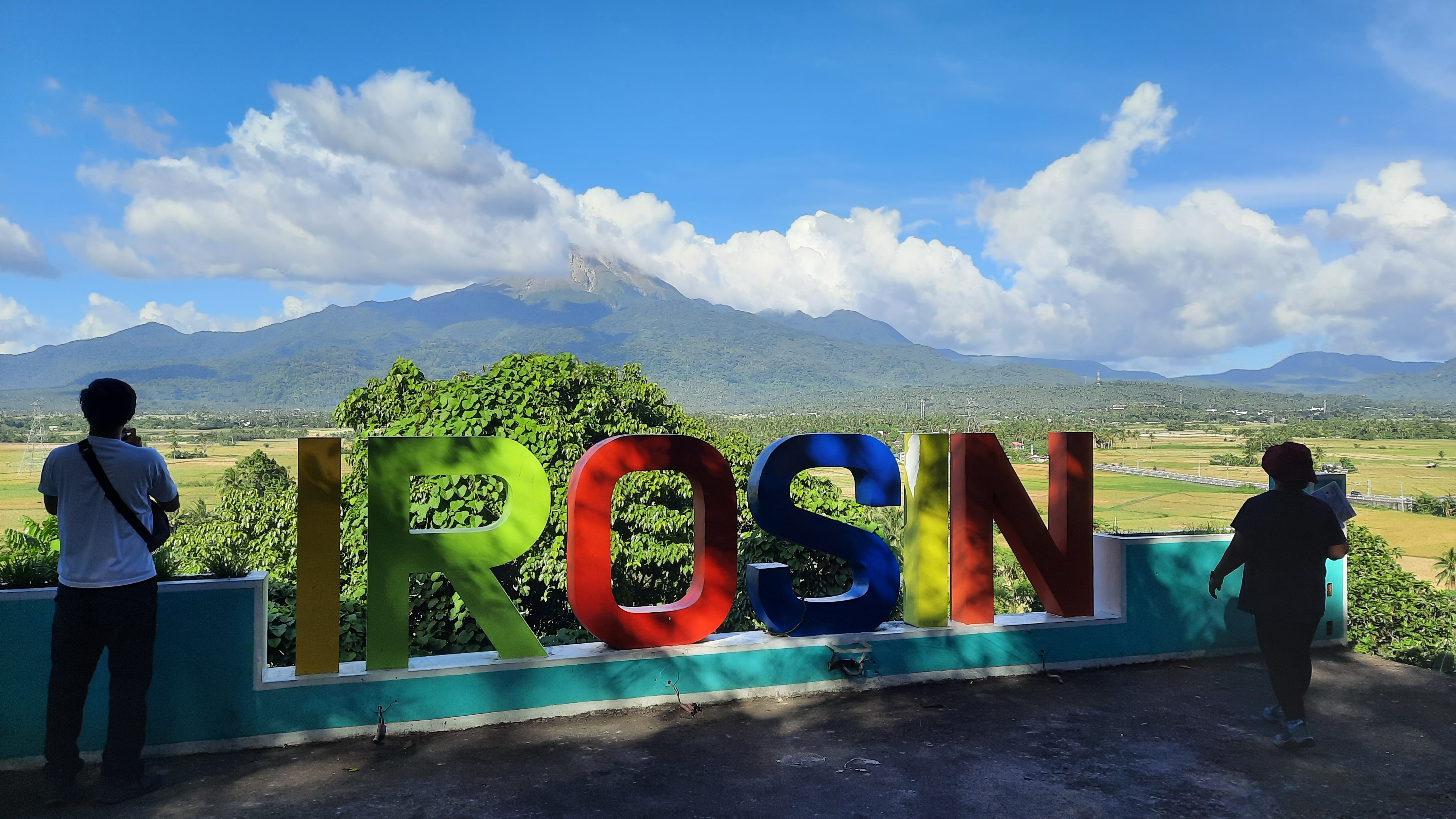
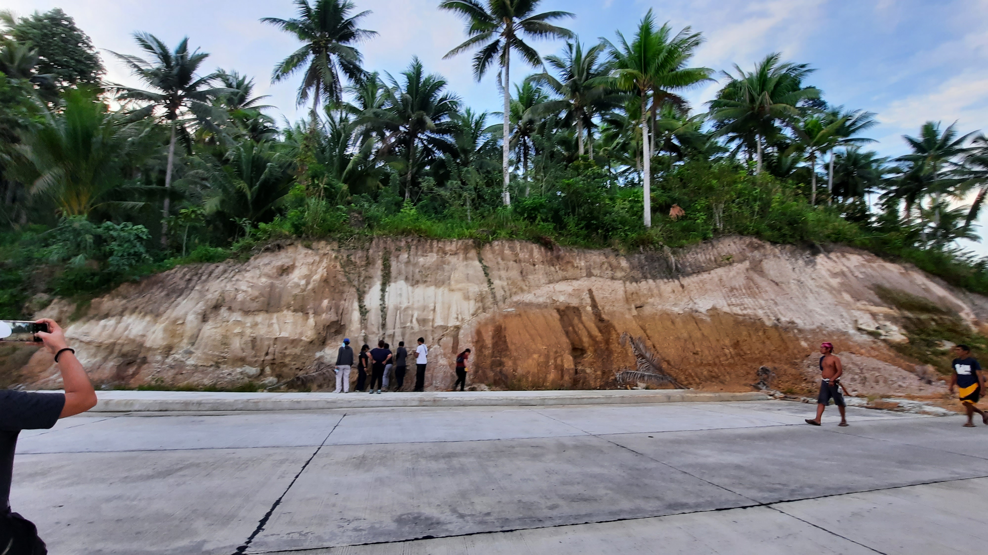
Did you know that the wide plain in the photo above, around Bulusan volcano, is a caldera known as Irosin Caldera? If you’ve seen photos of Taal or Mount Pinatubo, you’d see the one main thing that’s missing in Irosin Caldera. I’ll give you a moment to think about it. In the meantime, look down below for another shot of Irosin Caldera:
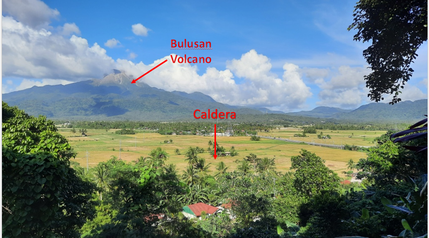
Have you guessed which feature is missing in Irosin Caldera? It’s WATER! Both Taal and Pinatubo have caldera lakes, Irosin Caldera has no water. It is possible that a long time ago Irosin Caldera had water or that it used to be a caldera lake. I believe this is the case based on the deposits we saw around it. However, very little studies have been done in the area that would explain why the lake dried up to what is is now. Something must have happened a long time ago that breached the lake. One thing is for sure though – the vast rice fields in the caldera owes its existence to Irosin Caldera. The volcanic materials underneath these rice fields contributed to the nutrients of the soil. We may as well call Irosin Caldera literally the rice bowl in Bicol because of its partial bowl-shaped topography owing to its geologic history.
The first volcanic deposit from Irosin Caldera that we saw along the way is this deposit of ignimbrite along the highway in Casiguran. From the highway this deposit would look cream to white with patches of orange due to soil formation process (weathering). There would be plenty of this type of deposit along the highway as we went around the caldera for three days.
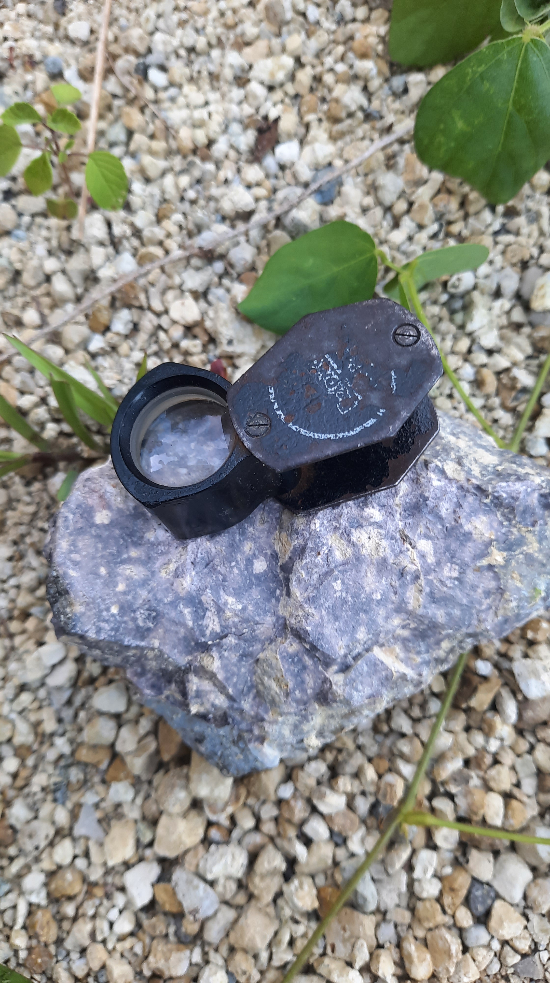
The photo above is an old volcanic deposit produced during the formation of Irosin Caldera. Photo on the left is a volcanic glass fragment with crystals and pumice fragments. In order to identify the crystals in volcanic fragments, geologists use hand lens such as my black one in the photo which has minimum of 10x magnification. You won’t catch a geologist at work without one, that’s for sure!
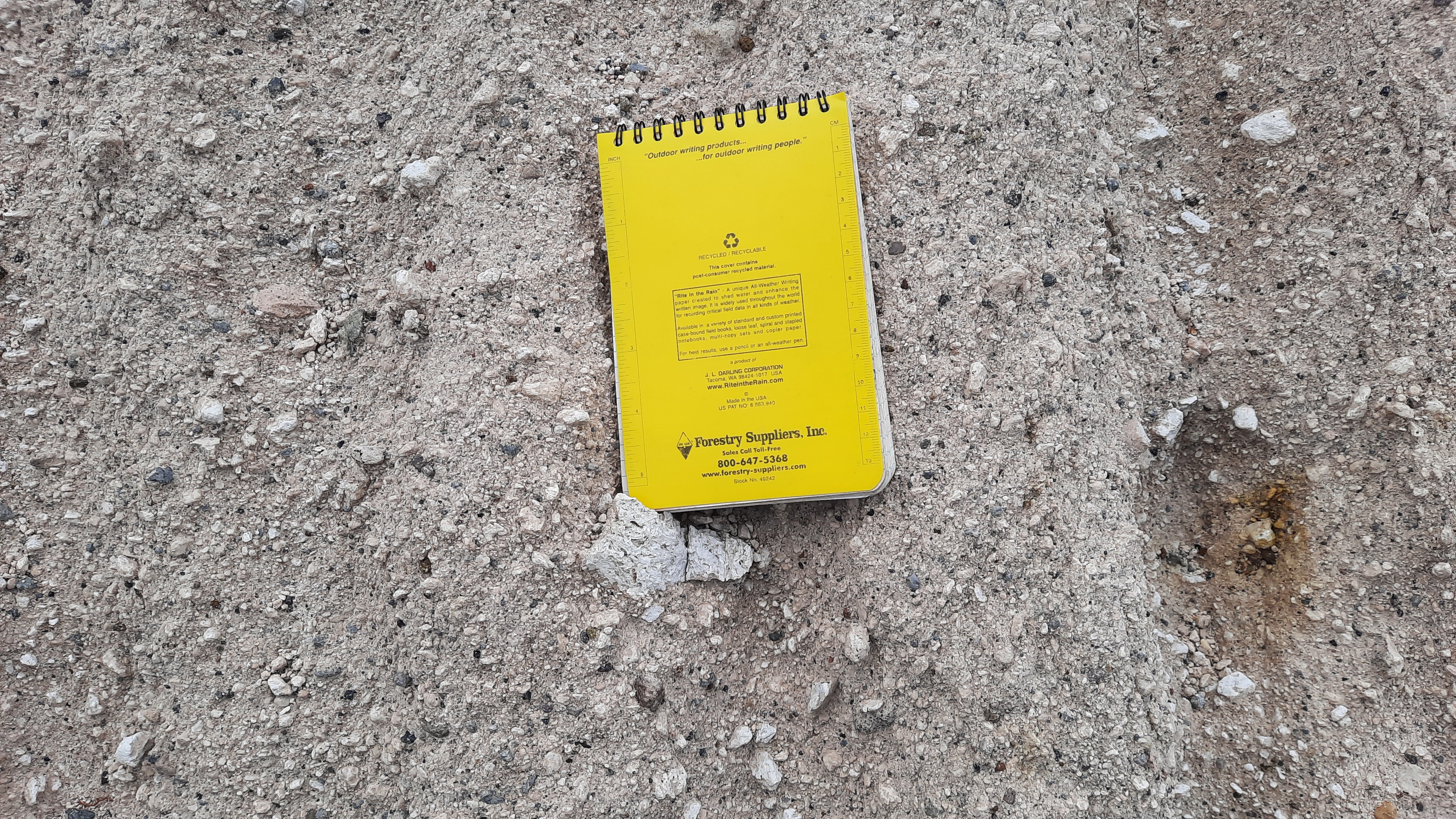
In the photo above is another deposit from the formation of Irosin Caldera. The yellow notebook is one of my Rite-in-the-Rain notebooks – yes, it’s waterproof and one can write on it even when there’s heavy downpour.
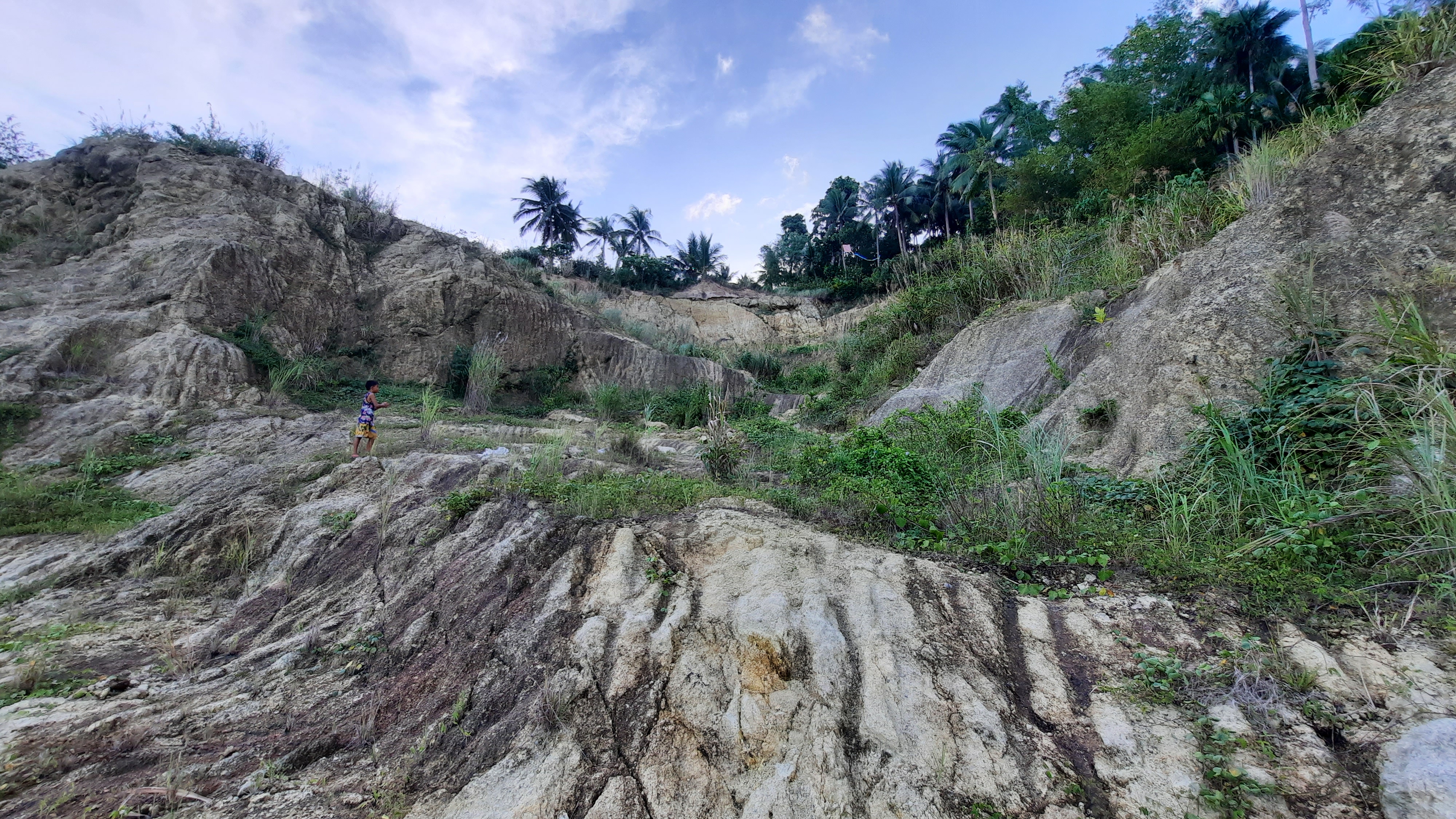
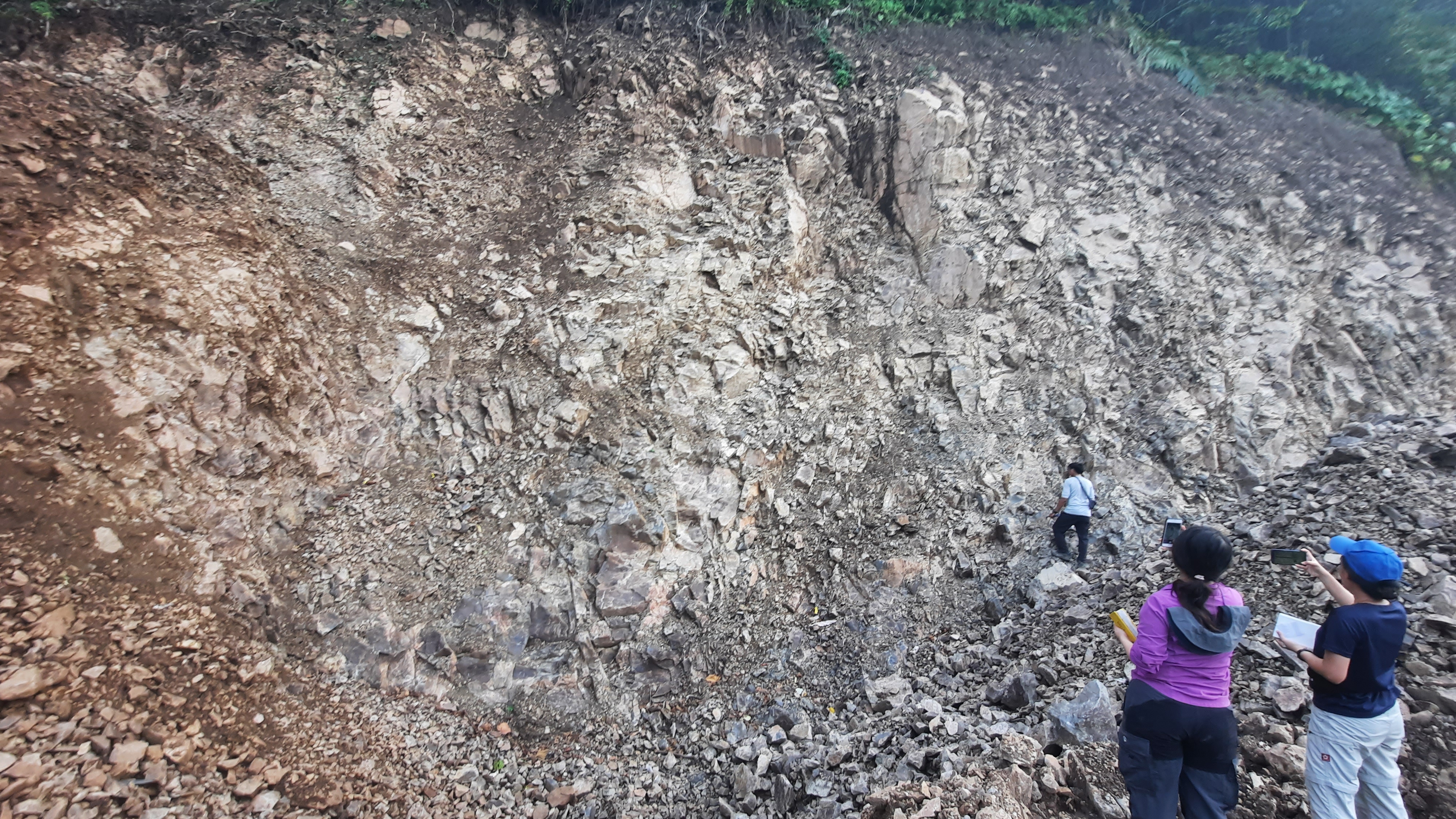
The new road constructions happening around Sorsogon Province was so advantageous for us – it exposed so many of Irosin Caldera deposits. The more deposits exposed, the more observation points geologists can have on the field. According to my professor, we saw more rock outcrops during our fieldwork because of new road networks compared to the last time she offered this volcanology course which was about two years ago. I guess luck was on our side! 🙂
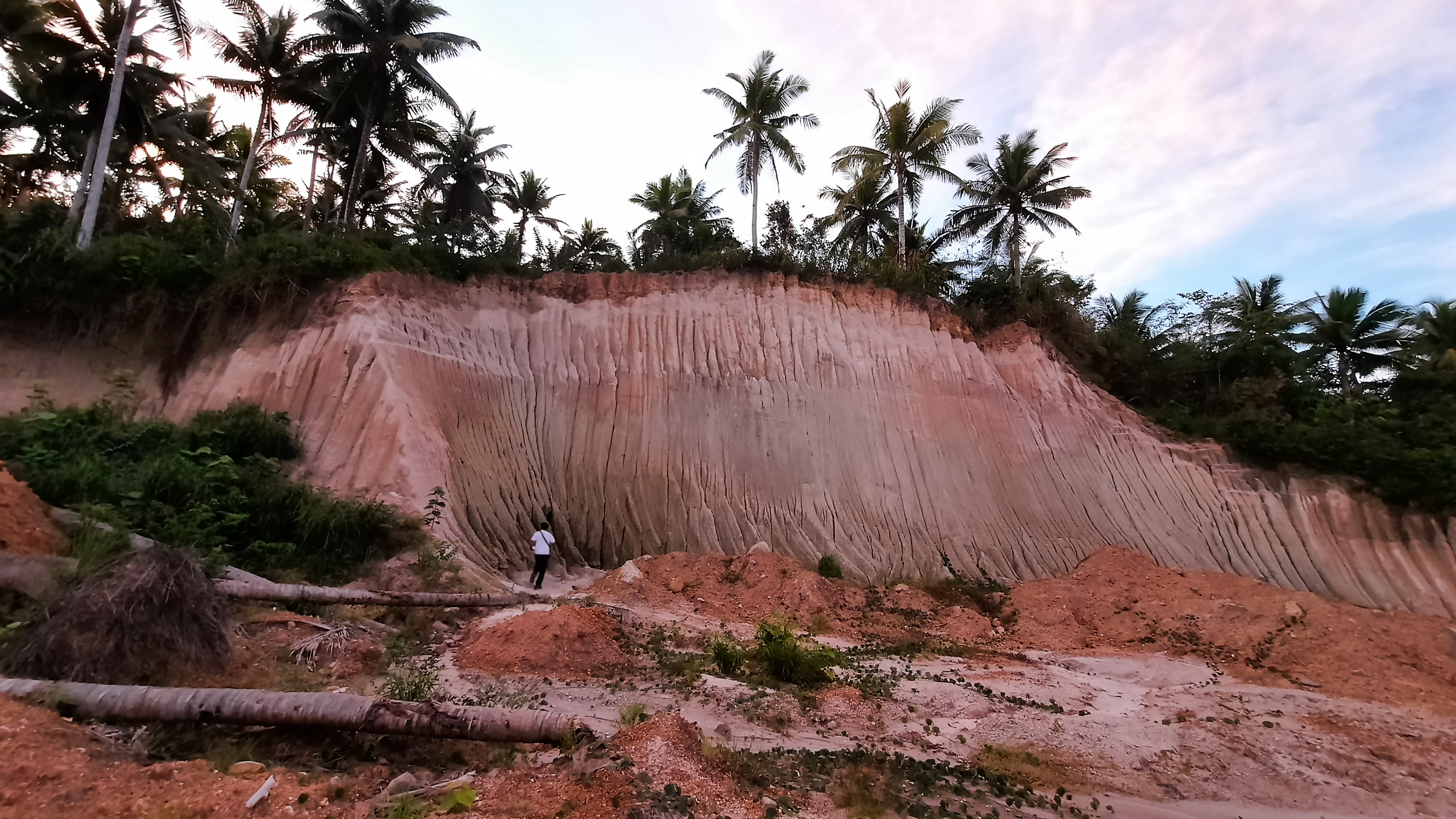
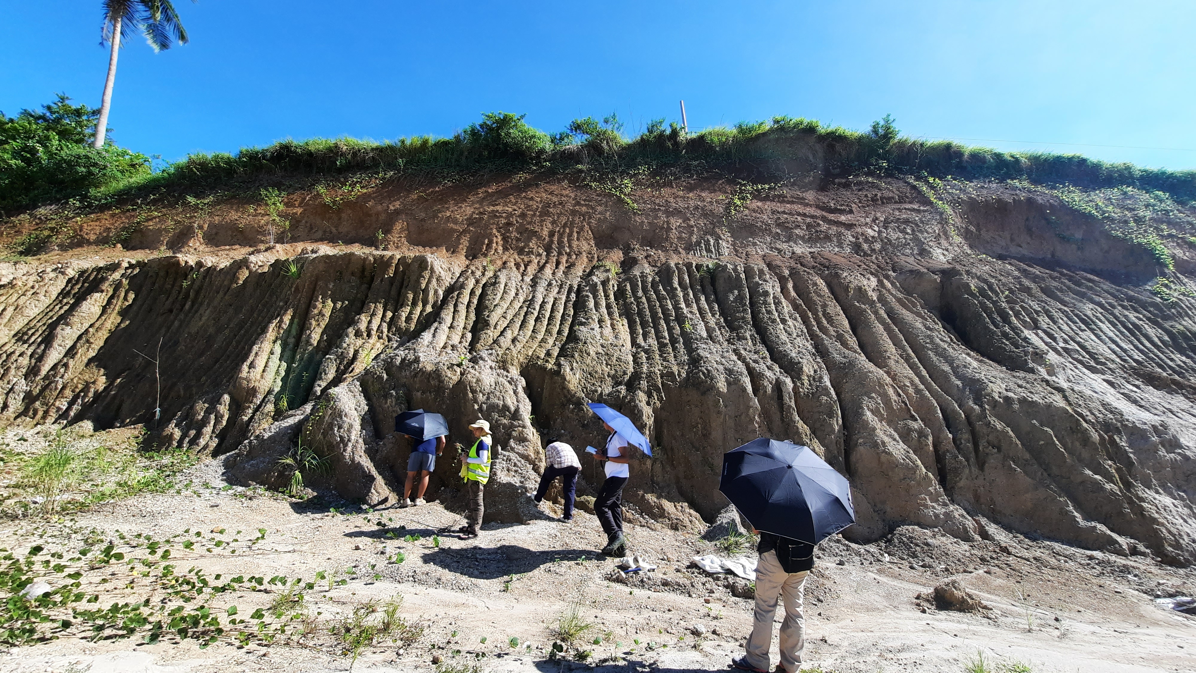
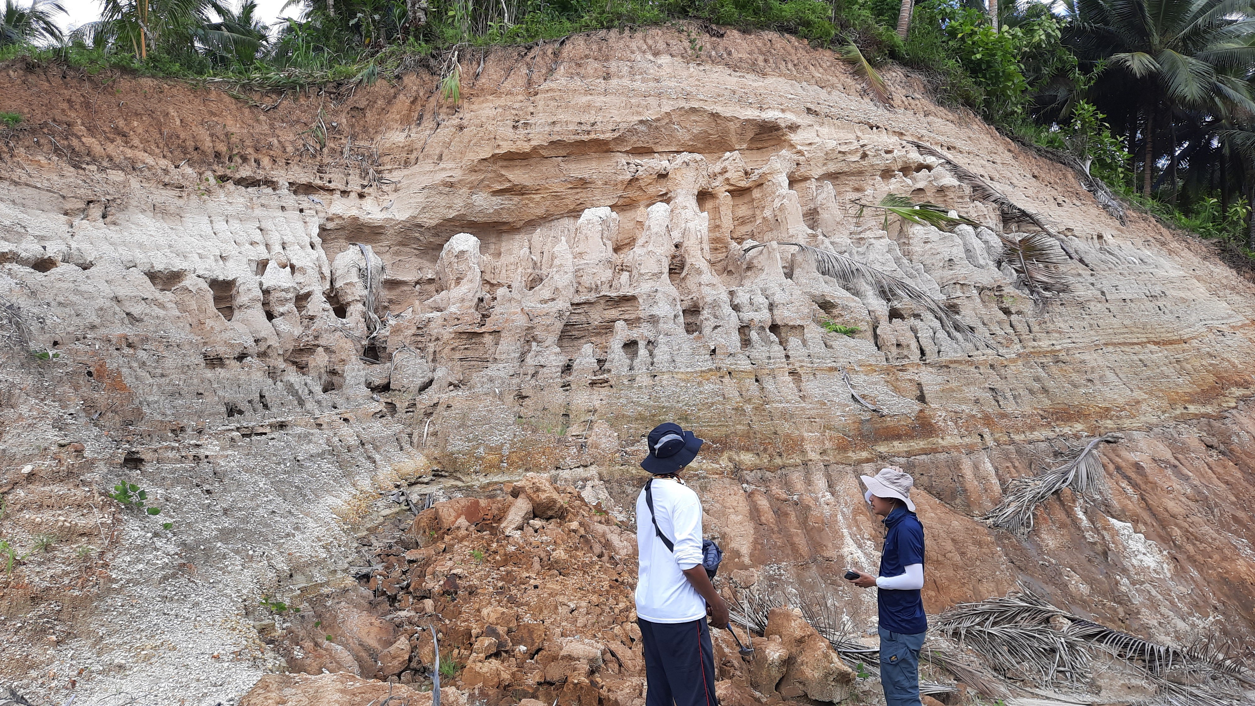
Photo below was taken of the first outcrop we visited on our second day in Sorsogon. This one is in Juban, Sorsogon. The abundant pumice fragments observed in this deposit and the presence of tephra fall layer near the top of this outcrop indicate one thing – the eruption that resulted in the formation of Irosin Caldera was a violent one.
The photo above is an spectacular outcrop of an epiclastic deposit. This outcrop indicates that some of the volcanic deposits were transported by water (e.g. river) from the vicinity of the caldera towards this site. Notice also how the erosion pattern resulted to pinnacle structures in this deposit? Pinnacle-shaped erosion formed because of the presence of less erodible grains that protect the deposit underneath. 🙂 If you can’t imagine what I just said, take a look at the photo below. The pumice grains and rock fragments in the layers sort of protected the sandy deposit underneath them, avoiding erosion, and thus, forming pinnacles. Awesomesauce!
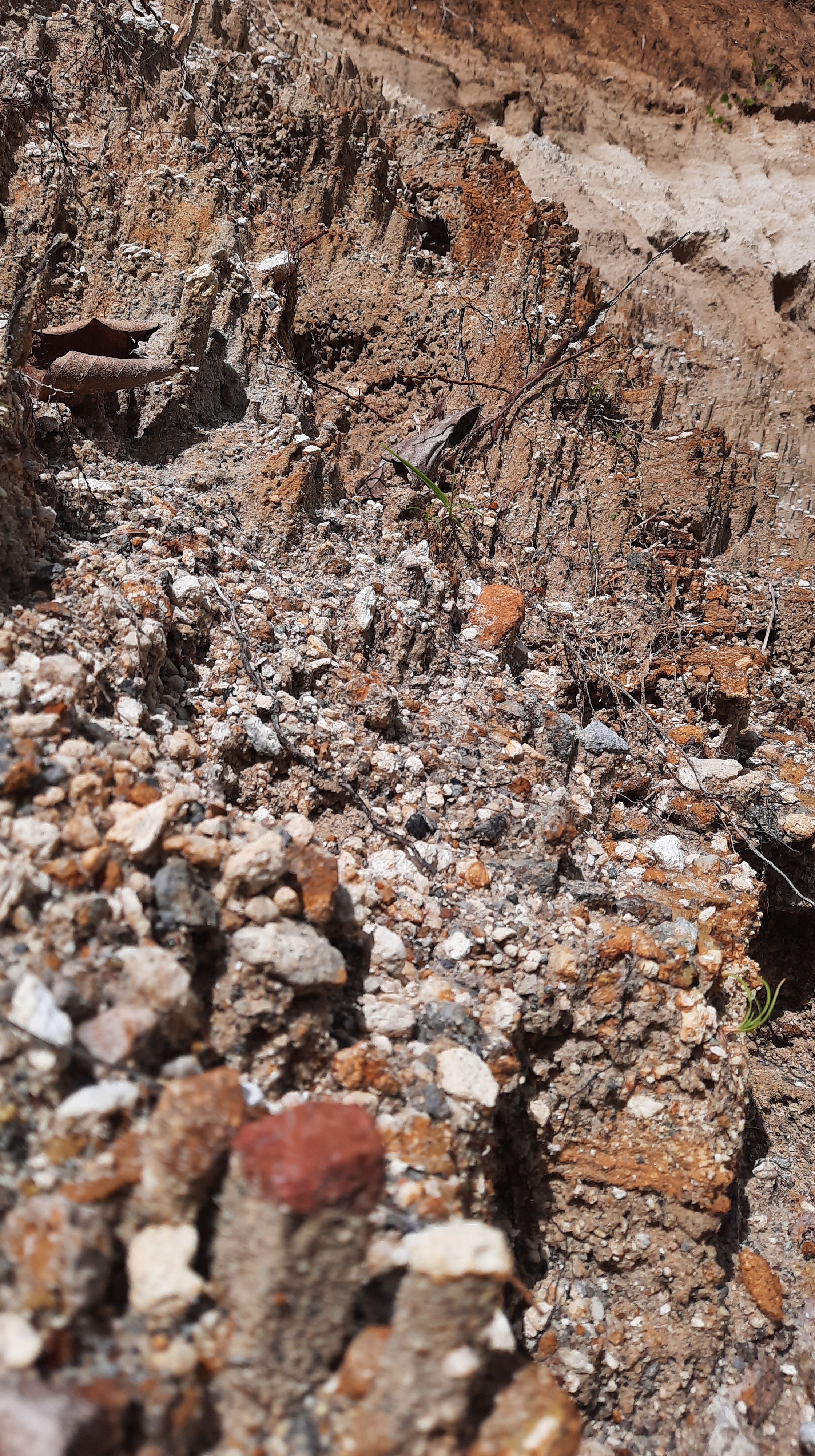
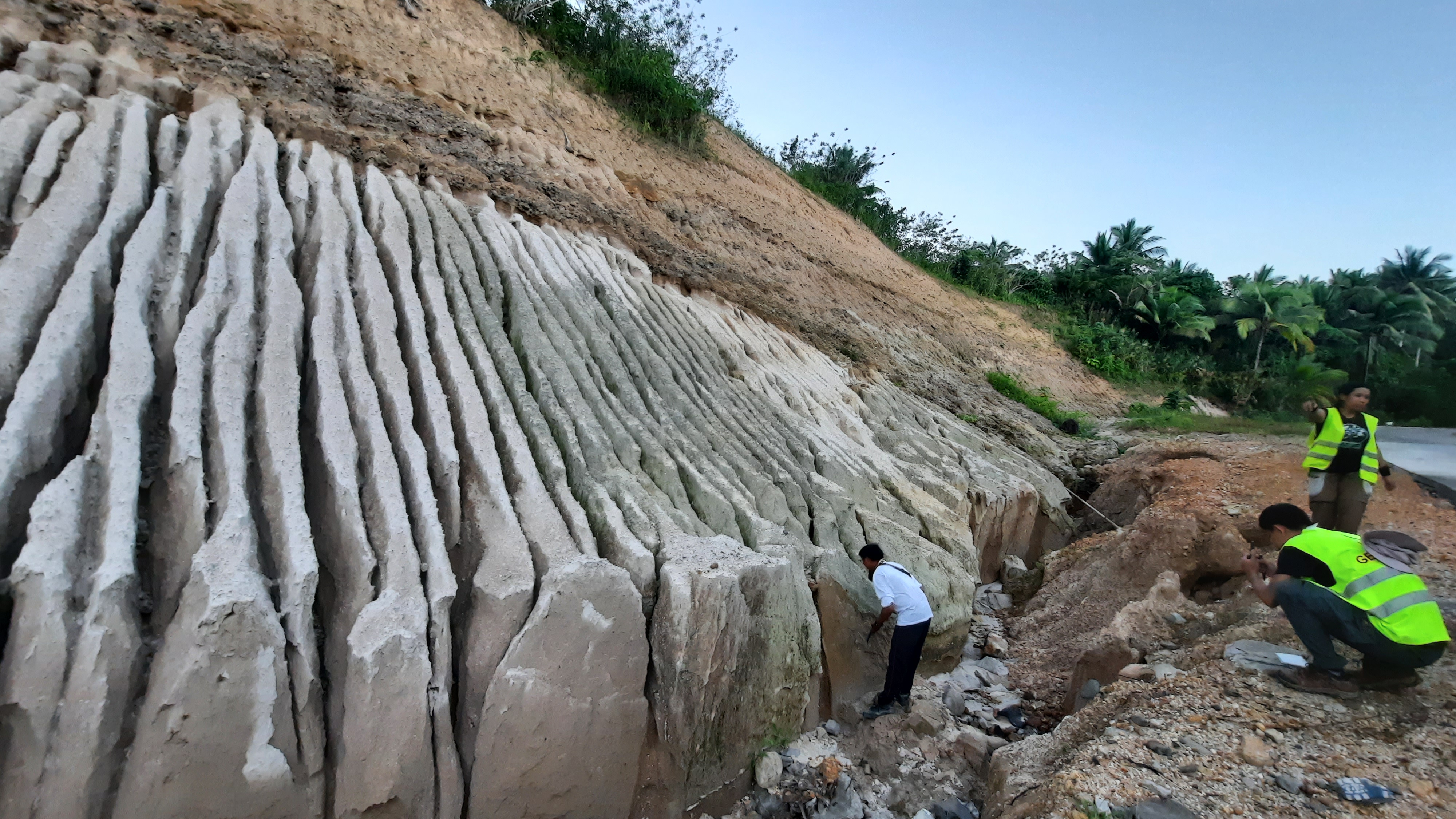
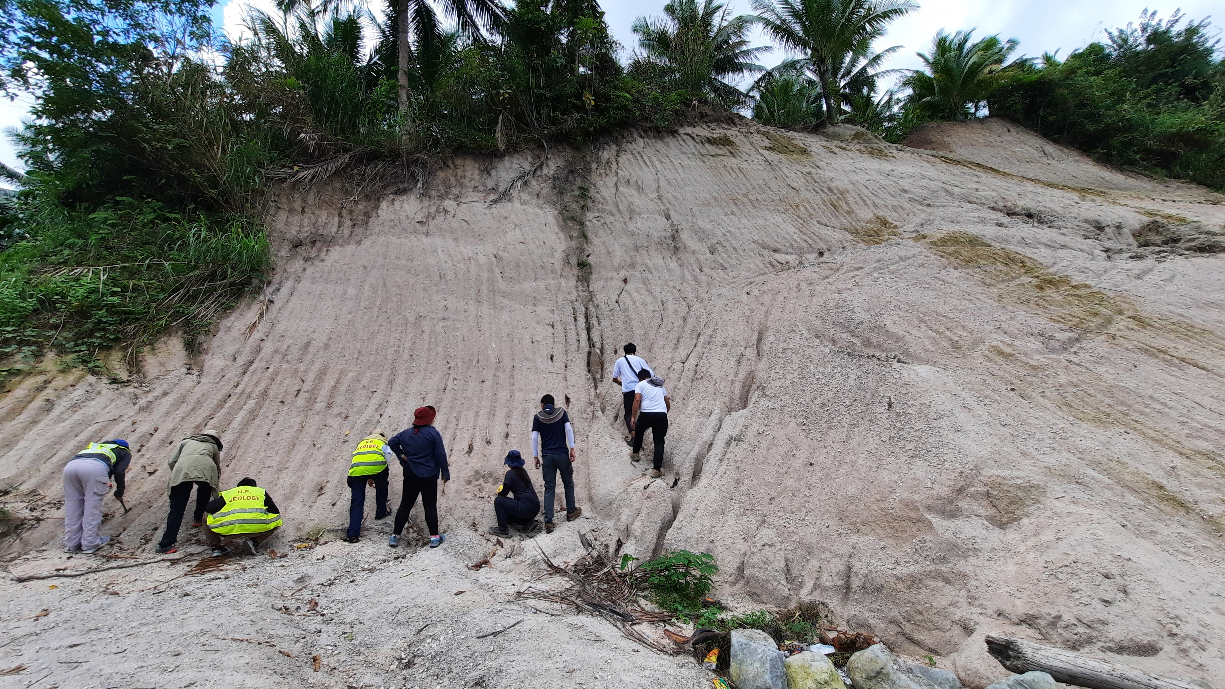
Speaking of erosion, one of the things that’s unique in volcanic materials that were violently exploded by a volcano such as the one in the photo above is the deep rills that form on it during erosion by rain water. From the different way rocks are eroded (look at the upper layer) then we know at first glance that there are at least two layers of deposits on the outcrop above. The color difference also indicates the same. Geologic work requires detailed observation of rocks. 🙂
Remember the molten lava in the video of Mt. Etna? When the molten lava freezes into solid rock it can look like the one in the photo above. For scale, look at my classmate in the photo and you can already tell that this lava flow is sooo thick!
There is still much to learn about Irosin Caldera and the several events that led to its formation which resulted to the birth of the active Bulusan Volcano. If you read this far, I hope you are inspired to consider geology as future career. The country needs more geologists especially ones who will pursue volcanology so our volcanoes can be understood. Understanding each volcano’s eruption events and their characteristics can help with predicting future volcanic eruption events. 🙂
xoxo
Discover more from The Fabulous Scientist
Subscribe to get the latest posts sent to your email.

1 thought on “Volcanology Fieldwork in Bicol – Revisiting Eruptive Deposits of Mayon, Bulusan, and Irosin Caldera”